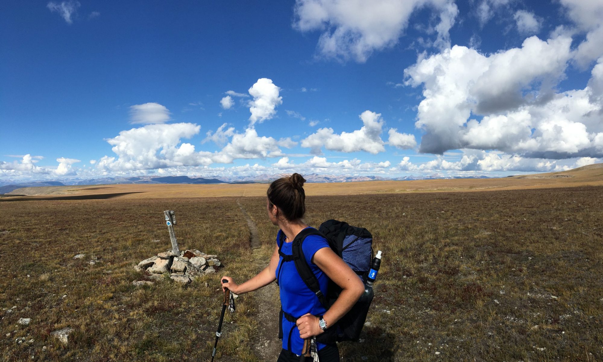
This spring, I hiked 850 miles of the Great Basin Trail. In this post, I’ll provide an overview of the trail and my key take-aways on what went well and what I’d change if I hiked it again. My intention is to provide potential hikers with an idea of what to expect, and to provide insight into my preparation process and considerations before I embark on any long distance trek.
Introduction to the Great Basin Trail
Length & Elevation Gain:
The Great Basin Trail is ~1100 miles, of which I hiked ~850 miles between May 16 and June 17 of 2021. It contains 194,000 feet of vertical gain.
Location:
The Great Basin Trail is a loop route and its entirety is located within the state of Nevada. It features a geographic region known as the Great Basin. From Wikipedia: “The hydrographic Great Basin is a 209,162-square-mile area that drains internally. All precipitation in the region evaporates, sinks underground or flows into lakes. The region is bounded by the Wasatch Mountains to the east, the Sierra Nevada and Cascade Ranges to the west, and the Snake River Basin to the north. The south rim is less distinct. The Great Basin includes most of Nevada, half of Utah, substantial portions of Oregon and California, and small areas of Idaho, Wyoming, and Baja California, Mexico. The term “Great Basin” is slightly misleading; the region is actually made up of many small basins. The Great Salt Lake, Pyramid Lake, and the Humboldt Sink are a few of the “drains” in the Great Basin.”
The Great Basin Trail travels through:
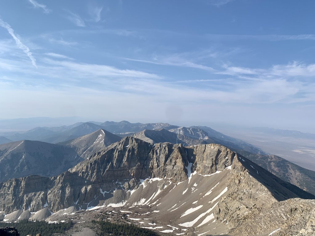
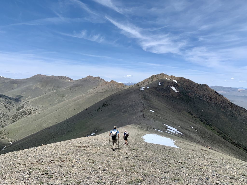
- 27 mountain ranges: Fortification, Wilson Creek, Highland, Chief, Delamar, South Pahroc, Hiko, Mt. Irish, Worthington, Quinn Canyon, Pancake, Hot Creek, McKinney, Toiyabe, Toquima, Monitor, Antelope, Fish Creek, Diamond, Southern Ruby, Ruby, East Humboldt, South Pequop, Dolly Varden, Schell Creek, Moriah, Snake
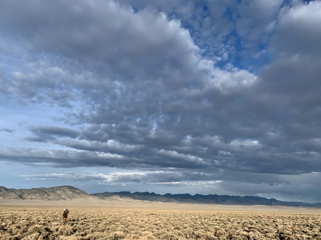
- 19 Basins/Valleys: Lake, Delamar, Pahroc, Pahranagat, Garden, Railroad, Hot Creek, East and West Stone Cabin, Ralston, Big Smoky, Monitor, Little Fish Lake, Huntington, Clover, Independence, Goshute, Spring (x2), Snake
- 17 Wilderness Areas: Fortification, Parsnip Peak, South Pahroc, Worthington, Quinn Canyon, Palisade Mesa, Arc Dome, Alta Toquima, Table Mountain, Antelope, Ruby, East Humboldt, South Pequop, Becky Peak, High Schells, Mt. Moriah, Highland Ridge
Trail Type:
The route mileage breaks down to about 30% cross country, 50% road, and 20% trail. A description of each category:
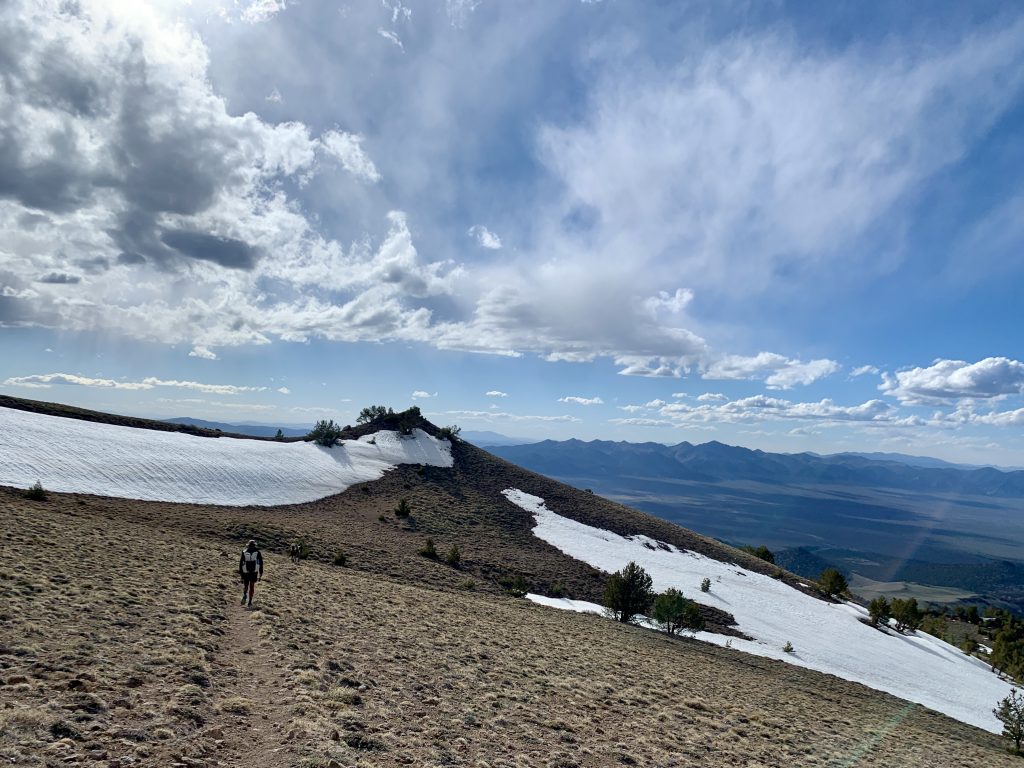
- Cross country: In the basin, the cross country hiking includes sections in which the hiker must weave her way through dense sagebrush, along with more open areas, such as playas, with less vegetation. Though exposed, hot, and dry, the basin walking provides a break from vertical gain and navigational challenges. In the mountain ranges, cross country travel includes long, ridgelines above tree line where walking surfaces range from large, stable boulders to loose ankle-rolling rocks and scree. Bushwhacking through sagebrush, mahogany, briars, streams, creeks, marshes, and groves of small, crooked aspen while going up, over, and through the ranges is not uncommon. There are occasionally horse and/or cattle trails which can be found and followed for easier travel through these sections.
- Road: Either faint two track or jeep track or dirt road. No pavement. Not your typical “road walk”, these miles are generally pleasant miles through scenic terrain. They provide a welcome relief to the more challenging cross country and trail miles.
- Trail: Occasionally distinct, clear, cushy trail, but more often overgrown, faint, or non-existent trail (which may have been marked on a map 100 years ago, but which no longer exists).
Terrain:
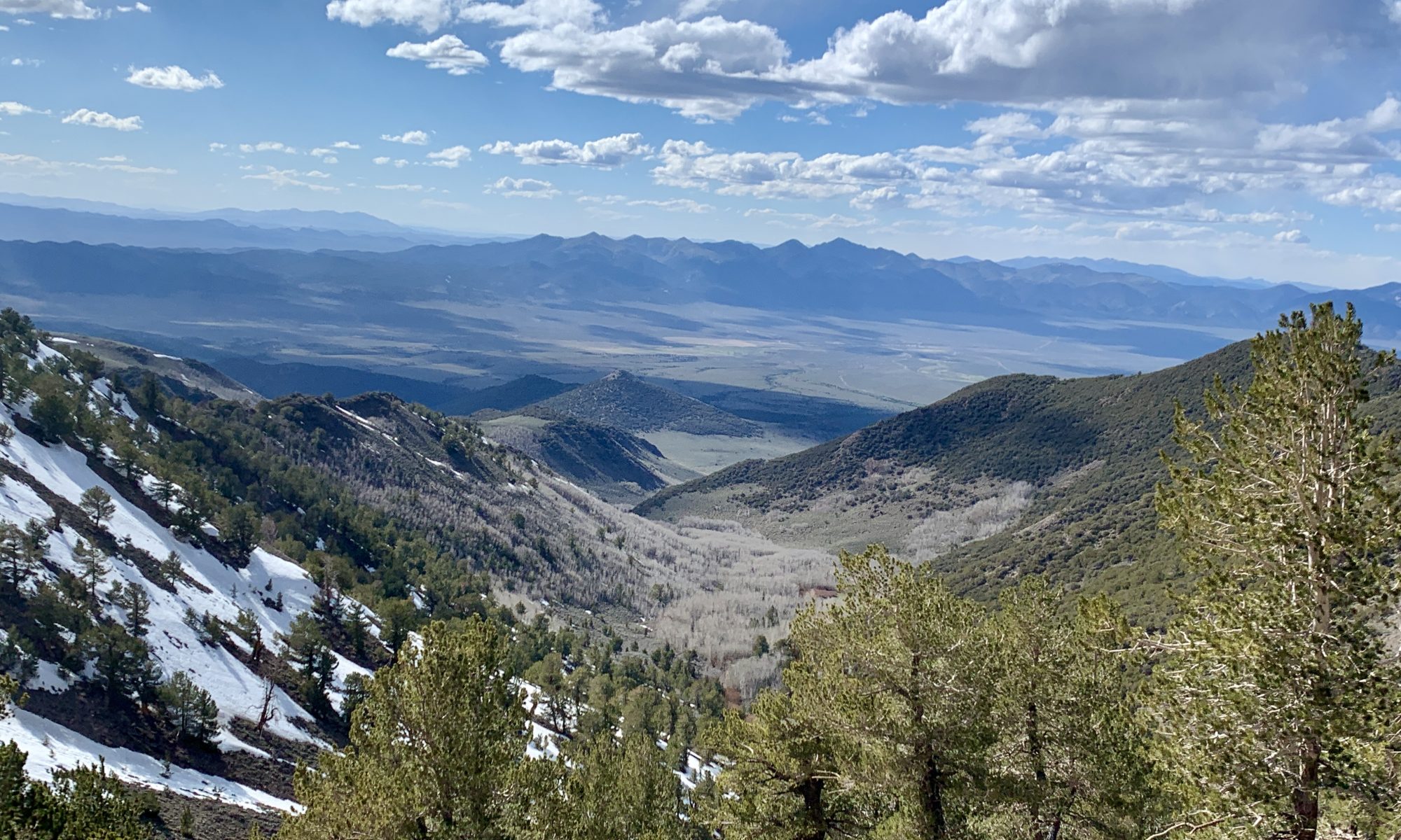
The Great Basin consists of basin and range topography, meaning that the landscape exhibits alternating parallel mountains and valleys. Generally speaking, the Great Basin Trail hiker can expect to travel over a mountain range, then drop down into a basin, hike across the basin, and then back up into a mountain range. This repeats throughout the loop with varying mileage in the ranges and valleys depending on which part of the loop you’re in and whether you’re hiking east/west or north/south in that section.
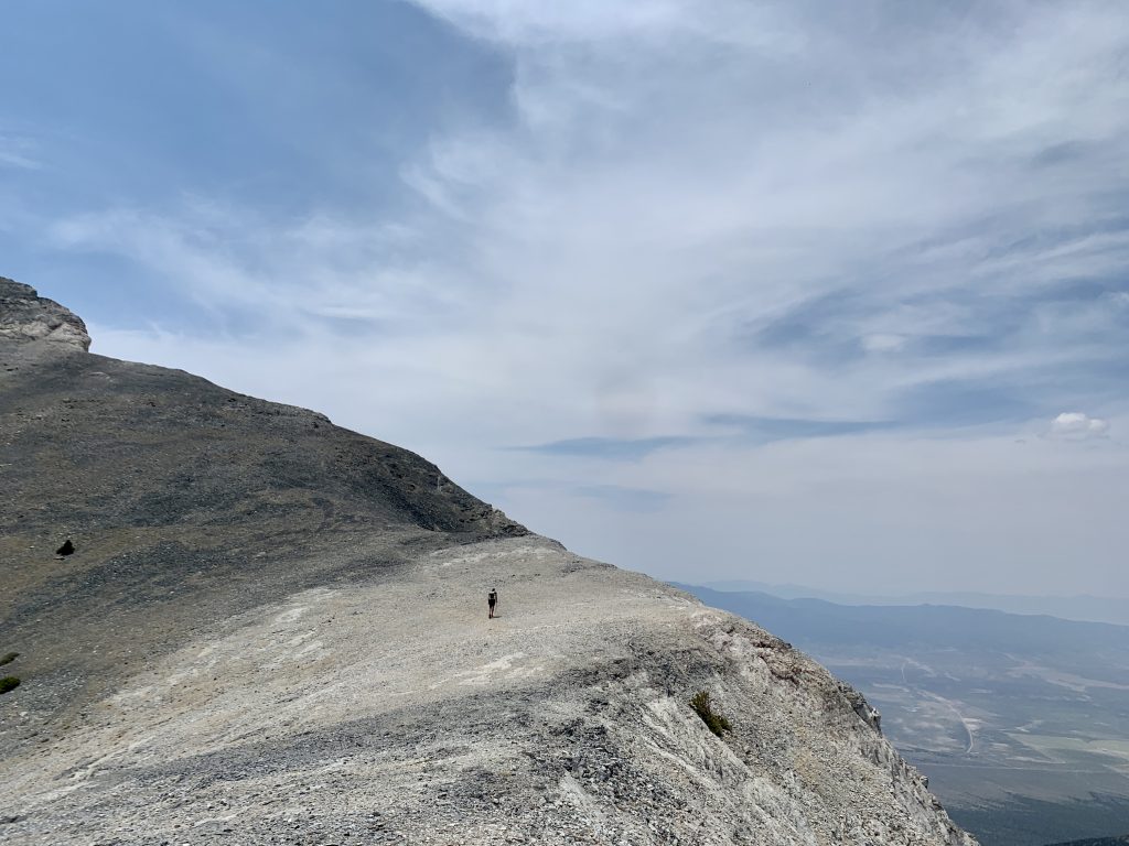
Scenery:
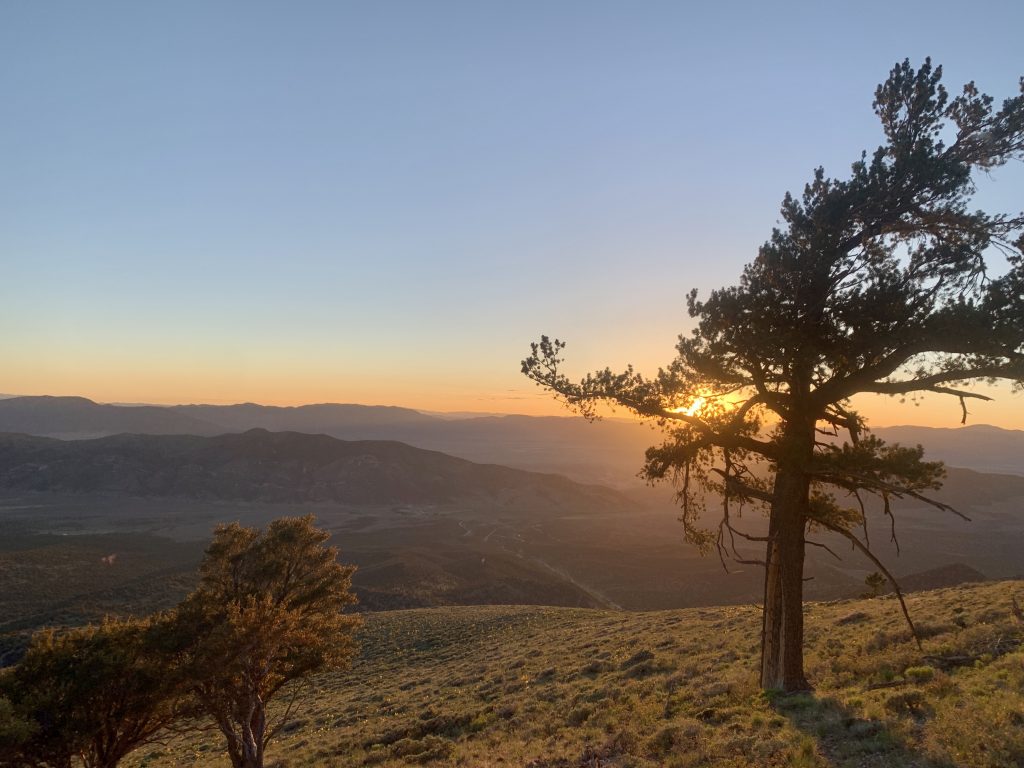
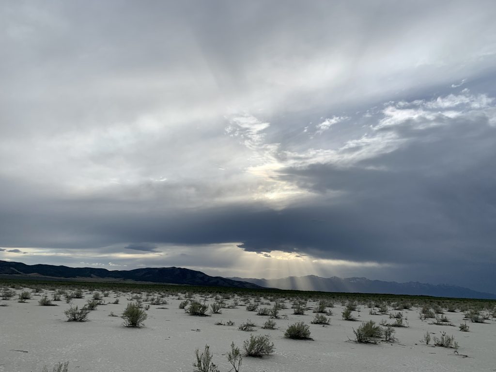
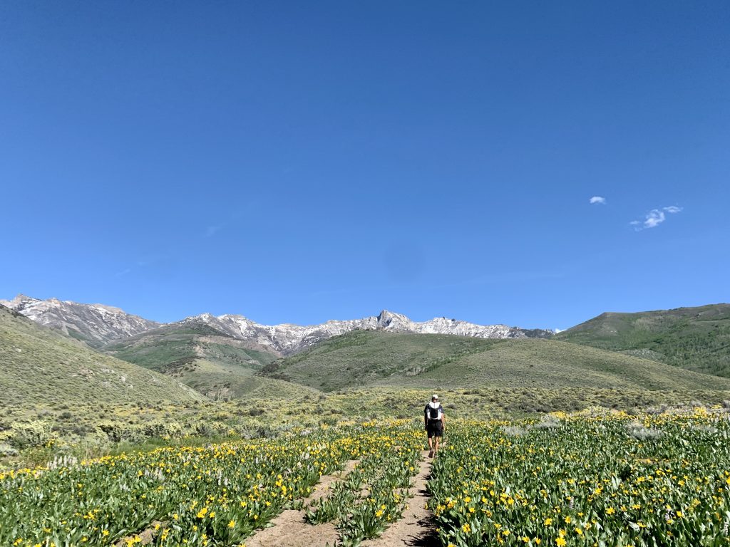
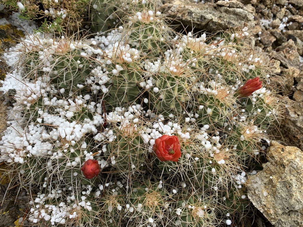
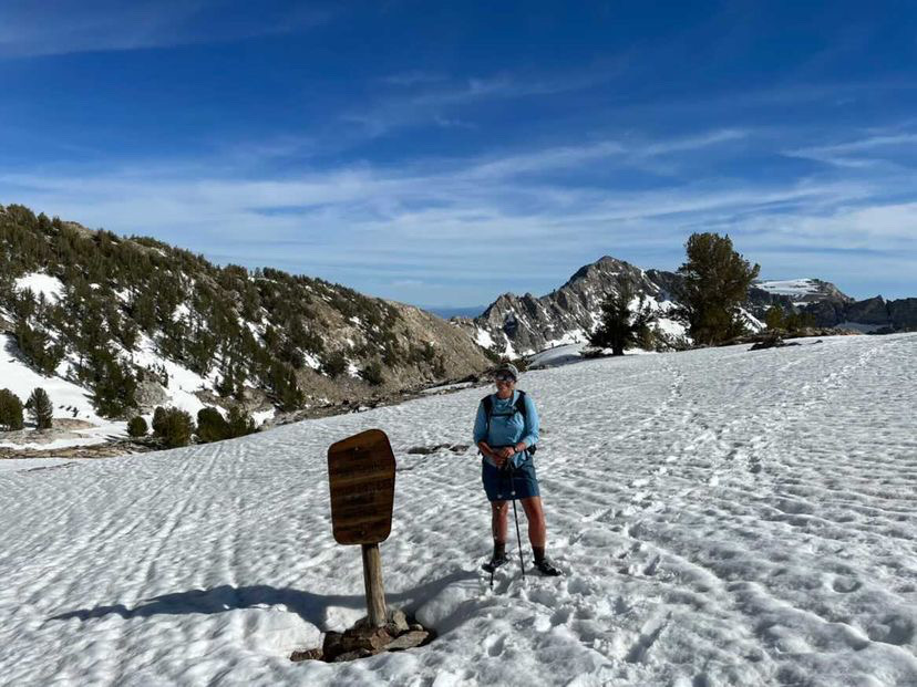
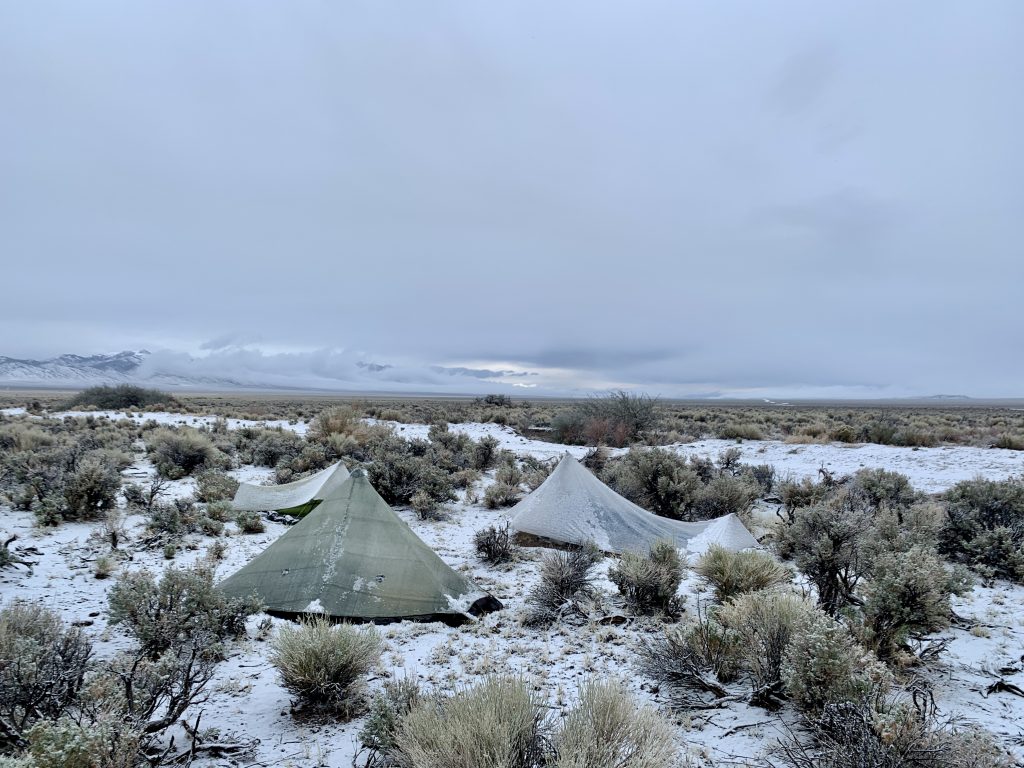
The scenery of the Great Basin Trail is diverse. There are endless horizons, seas of sagebrush, impossibly dark starry nights, and 360-degree ridgeline views featuring layers upon layers of mountains. And that’s just a taste. The best way to get a sense of what the trail looks like is to see my GBT highlights on my Instagram page: @katiegerber.
Climate, Weather & Optimal Hiking Season:
The Great Basin is known to be a harsh environment. It’s arid, often extremely hot, and weather changes can occur quickly. I started hiking in mid-May near Tonopah on the southwestern portion of the loop and hiked clockwise. In my first week on trail, I hiked through shade-less basin stretches in 90-degree heat and then through rain, snow, hail, and fog just days later. Aside from the storms in the first week or so, there was very little precipitation for the remainder of my hike. Hiking clockwise around the loop, daytime temperatures for most of the trip were pleasant: 60s to low 70s in the mountains and high 80s in the basin. Towards the end of the hike, nearing Great Basin National Park in mid-June, temperatures in the basins got up into the high 90s and became uncomfortably hot. I wouldn’t have wanted to be on the southern portion of the route any later than mid-June. Spring and fall are ideal times for hiking this trail to experience the most moderate temperatures.
Potential hikers should note that this route requires skill in desert hiking. Learn the foundations of backcountry safety, including hot weather and desert hiking, in the Stay Safe in the Backcountry online course.
Navigation:
The Great Basin Trail requires the hiker to be proficient in off trail travel and navigation. I utilized paper maps (1:24,000 scale printed on 11×17 paper), a compass, and GPS tracks loaded to the Gaia GPS app on my phone. I mostly used the GPS to navigate while hiking, but appreciated having paper maps to give me a better sense of the broader area through which I was traveling. The maps also came in handy when determining detours due to weather and, of course, provide a backup in case my phone broke, got lost, or failed. Plus, paper maps are just fun to look at.
If you’re interested in improving your navigational skills so that you can embark on your next trip with more confidence, check out the Become a Better Backcountry Navigator online course.
Water & Resupply:
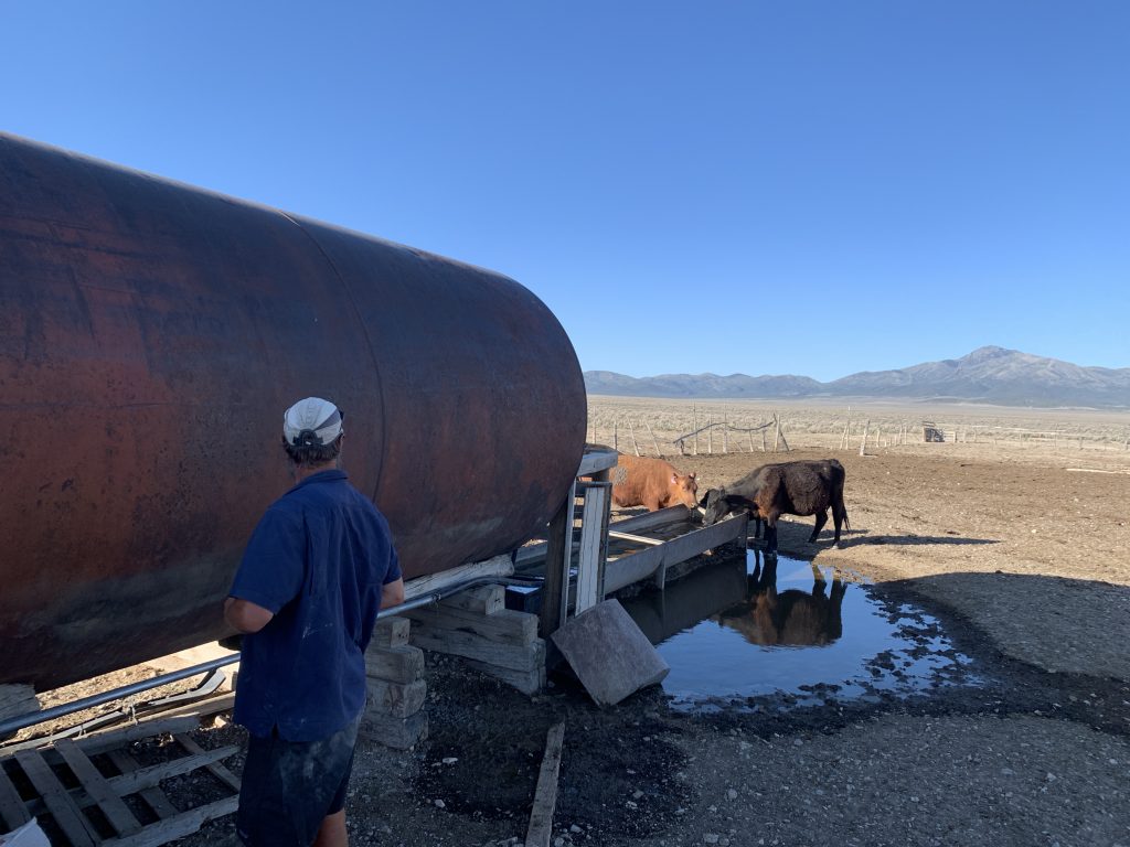
One of the most common questions I received while hiking the route was about water sources and availability. Water on the Great Basin Trail was surprisingly plentiful considering that the Great Basin is one of the most arid regions in the country. Ryan ‘Dirtmonger’ Sylva, the route creator, did a fantastic job of scouting out and mapping a surprising number of water sources along the route. These included springs, creeks, and rivers, as well as livestock guzzlers and troughs. His GBT resources include a water chart that lists potential sources along with degree of reliability. Though water was less abundant overall this spring than in previous years, all but one of the mapped sources had water, and the longest water carry was about 45 miles.
Questions? Comment below!
One Reply to “The Great Basin Trail: Trip Report & Guide”