How to Hike the Oregon Desert Trail: 750 Miles Across Eastern Oregon

oregon desert trail

This post originally appeared on the Trek.

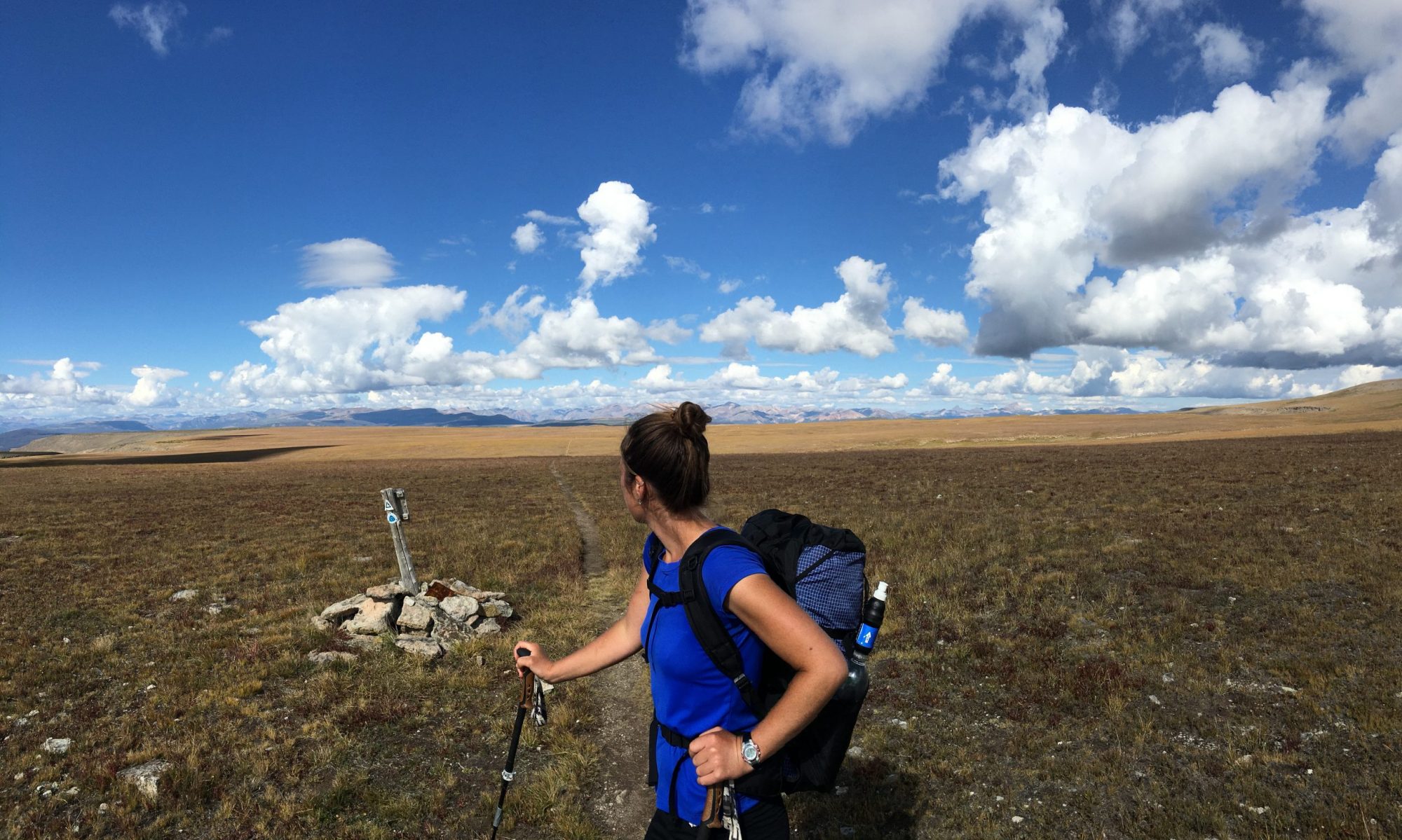
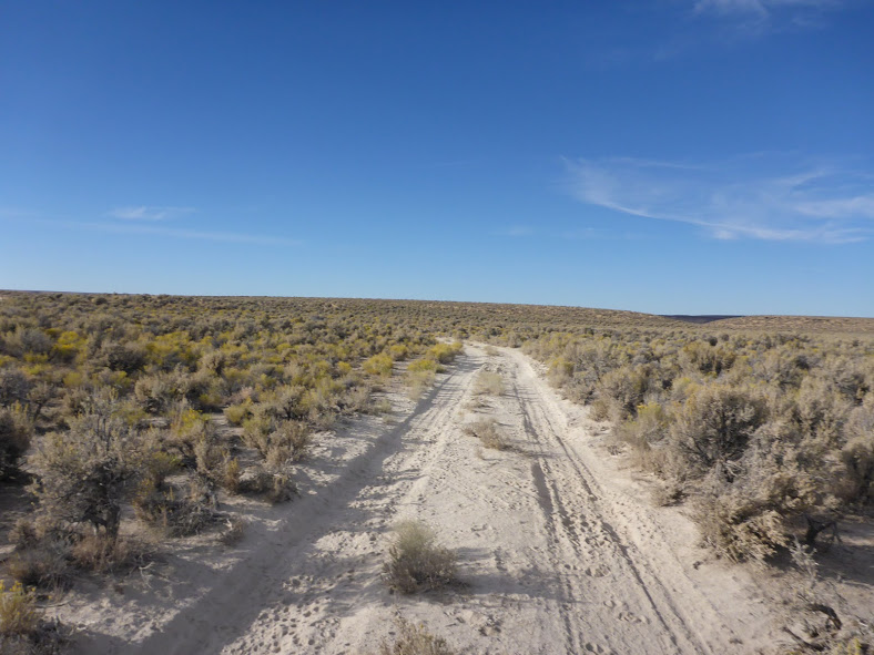
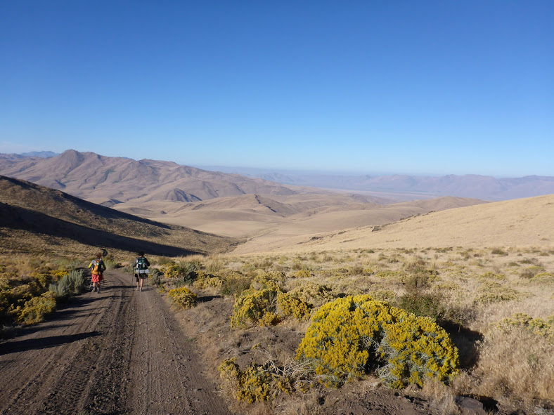
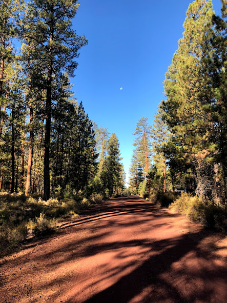
The Oregon Desert Trail (ODT) is a 750-mile route through the high desert country of Eastern Oregon. In the shape of a lopsided W, the Oregon Desert Trail made is up of a network of trails, cross-country travel, and two-track dirt roads. Oregon Desert “Trail” is a bit of a misnomer as the route is actually only 9% trail. The remainder of the miles are comprised of 35% cross-country travel, 51% unpaved/dirt roads, and 5% paved roads. The route was established in 2011 and has been thru-hiked by fewer than 30 hikers, who generally take four to six weeks to complete it. The ODT traverses some of the most spectacular natural areas of Oregon’s dry side, including Hart Mountain National Antelope Refuge, Steens Mountain, and the Owyhee Canyonlands.

Oregon Desert Trail At-a-Glance

ODT
  • Distance: 753.5 miles (variable depending on the specific route you choose).
  • Location: Southeast Oregon.
  • Trail type: Point-to-point.
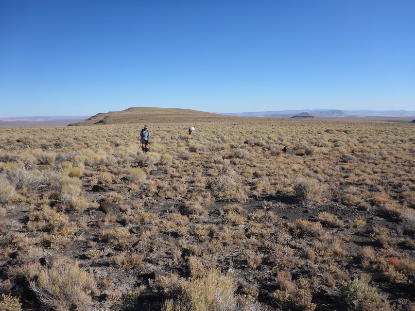
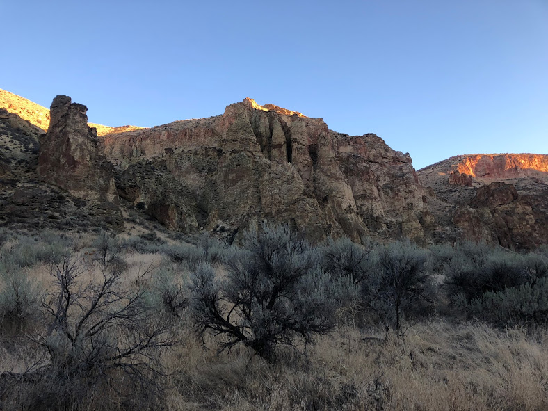
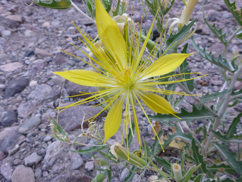
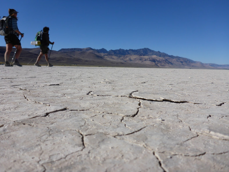
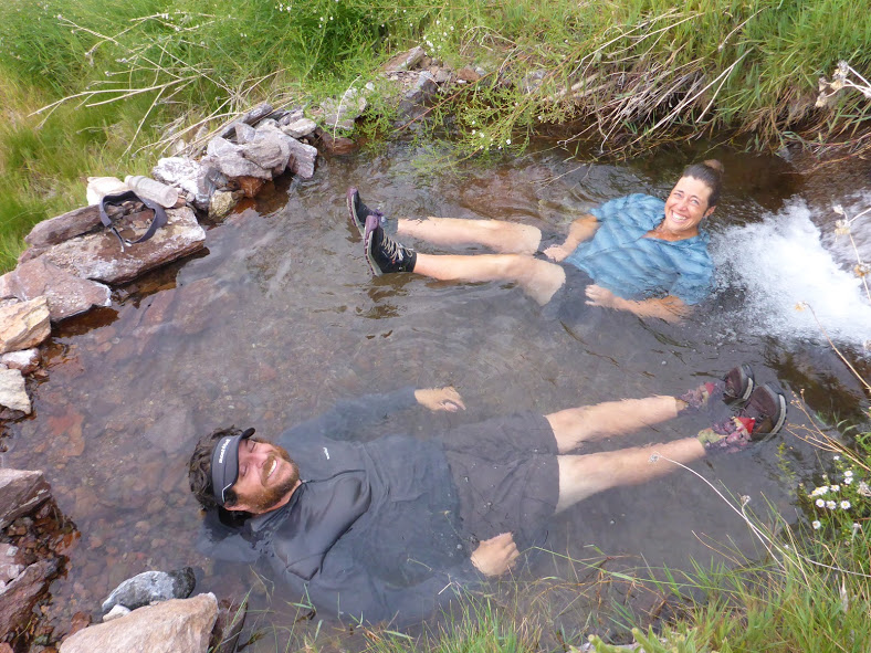
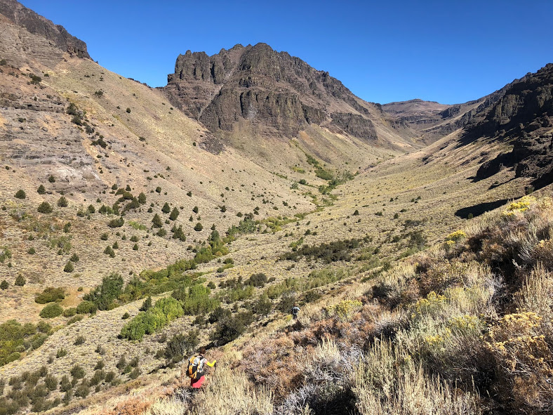
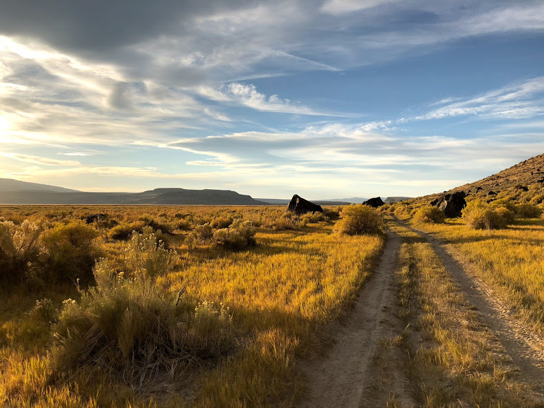
  • Scenery: Sagebrush seas, fault-block mountains, lava beds, canyonlands, pinyon-juniper forests, deserts, and hot springs.
  • Terrain: Moderate to difficult, with rolling hills to river crossings and steep off-trail navigation through dense vegetation.
  • Navigation: The route is unmarked and requires map and compass skills and/or use of a GPS. The best resource for maps and way points is the Oregon Natural Desert Association (ONDA) website. There are occasional cairns or sections where the route follows other signed trails, but this is rare.

Getting There

oregon desert trail

The termini are located in the Oregon Badlands Wilderness near Bend, OR, and in Lake Owyhee State Park, near the southwest border of Idaho. The trail can be hiked east to west or west to east. For most people, accessing the Western Terminus near Bend is easier. You could fly into Redmond Municipal Airport, 17 miles from downtown Bend, and taxi or Uber to the Badlands Wilderness, or to the bus station (see below) if you’re starting at the Eastern Terminus.

The Eastern Terminus at Lake Owyhee State Park is more remote. If you can find someone to drop you off, that’s definitely the easiest option. If that’s not possible, take the POINT bus Eastern route from Hawthorne station in Bend to Vale/Ontario and taxi from there. A possible option detailed on the ONDA website is trail advocates in the Lake Owyhee area who may be willing to help out hikers with transportation. Be a good trail steward and treat these people with generosity and kindness.

Of interest for those planning a section hike of the trail, the ONDA website offers the following information: “The Lake County Senior Citizen Association (LCSCA) Lake County Public Transportation program offers rides around Lake County. The priority for the service is for seniors needing medical services, but if space is available hikers are welcome to ride. Trips may travel between Christmas Valley, Bend, Paisley and Lakeview. The cost depends on location (usually between $10-20). Call to inquire about availability and schedule: 541-947-4966.”

Which Direction Should You Hike?

oregon desert trail

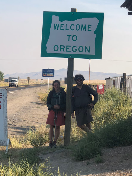
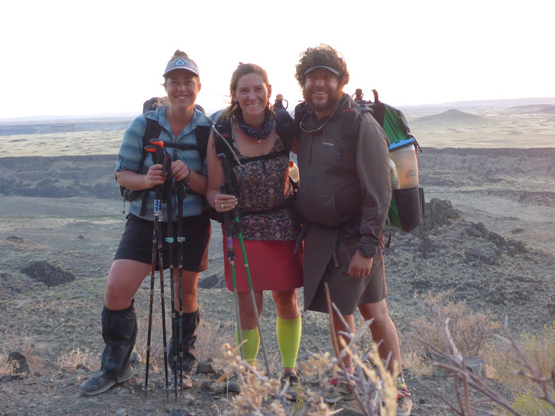
This trail can be hiked in either direction. Most ODT thru-hikers have gone eastbound, but in the last few years, at least five of us have gone westbound. The pros of traveling westbound include finishing in Bend, with its many tasty restaurants and 22 microbreweries (the highest per capita in the US). Getting home from Bend is also likely to be easier. On the downside, westbound travel means more challenging terrain at the start of your hike. Traveling eastbound, on the other hand, may mean more logistics getting home from the Eastern Terminus, but more gentle terrain to start and a much more scenic finish at the spectacular Owyhee Lake terminus.

Why Hike the Oregon Desert Trail

hot springs ODT

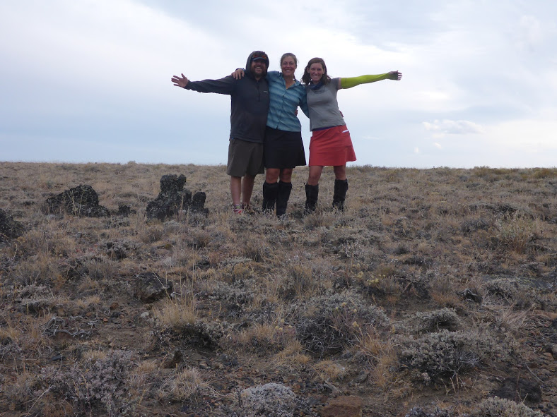
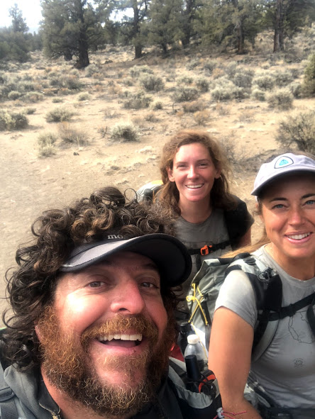
The ODT is unlike any other trail you’ve hiked, and that alone is a good reason to hike it. Southeast Oregon is one of the least densely populated regions of the country and many of the towns you travel through are one stoplight with one combined gas station/convenience store/bar/post office. I found that being on a trail without so much trail culture around it made for more genuine interactions with the locals.

Another reason to hike this trail is the lack of crowds. The total number of permits issued for the PCT in 2018 was 7,313. That’s in stark contrast to the number of other hikers I saw aside from my hiking partners, which was zero in 30 days. This provides a wonderful opportunity to unplug and truly clear your mind.

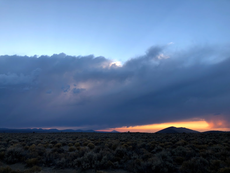
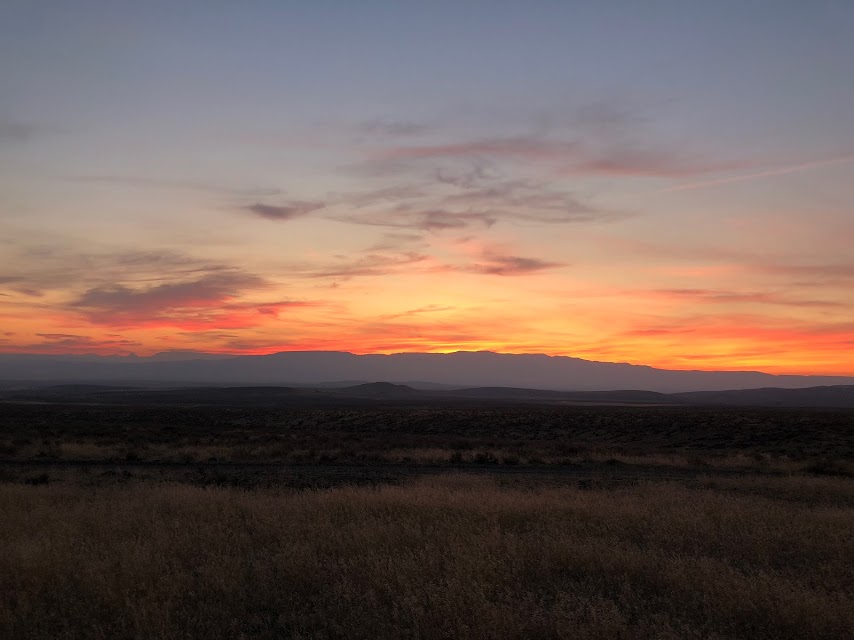
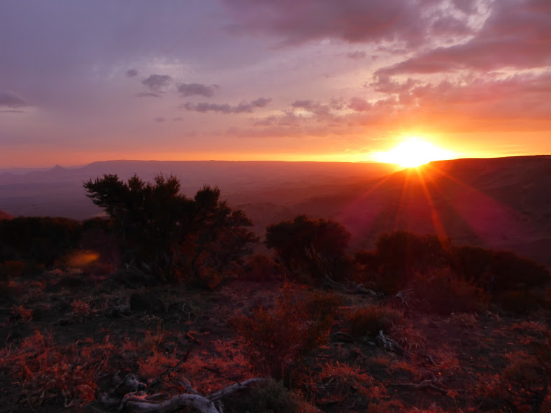
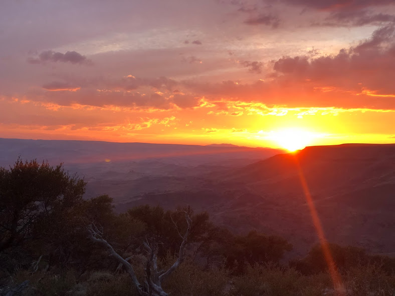
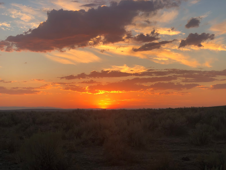
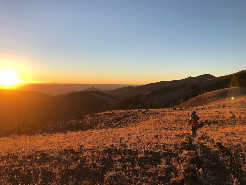
Another benefit of the remoteness of the ODT is the lack of light pollution, which allows for some of the most incredible night skies I’ve ever experienced. The wide-open expansive horizons also showcased vibrant sunrises and sunsets almost daily.

I found that being on a trail without so much trail culture around it made for more genuine interactions with the locals.

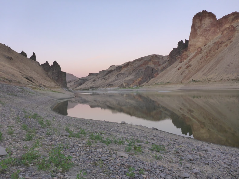
This trail also passes several hot springs, including Summer Lake Hot Springs and Hunter’s Hot Springs, as well as Hart Mountain Hot Springs, Alvord Hot Springs, and several soaking pools in the Owyhee Canyonlands. This is thanks to the region’s rich volcanic history, which adds to the interesting geologic features of the region.

Aside from all this, the greatest reason to hike this trail is for the freedom and challenge it provides. From heat to navigation to water challenges, the ODT will test your limits every day. Furthermore, the freedom to hike as you wish, without anyone telling you you’re “doing it wrong” is also extremely refreshing.

Climate, Weather, and When to Hike

cow tank water

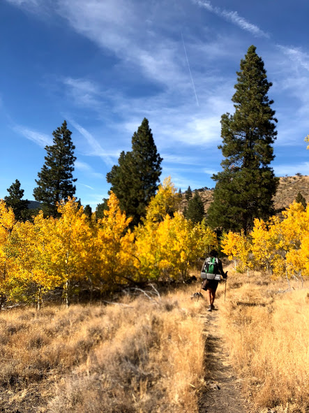
This region gets HOT in the summer, making the ideal seasons for hiking here in the spring or fall. Each option has its own unique challenges and considerations. For example, water is more likely to be available in the spring than in the fall. However, if you start late enough, the fall is likely to be cooler. I also just find autumn to be a very pleasant time to be in the desert.

We completed our ODT thru-hike from Sept. 1-30. The first week, daytime temperatures were in the high 80s and low 90s, but cooled  to high 50s and mid 60s later in the hike. Our nighttime temps ranged from low 20s to mid 40s. The only rain we experienced was a brief shower our last morning on trail.

Oregon Desert Trail Gear Suggestions

ODT

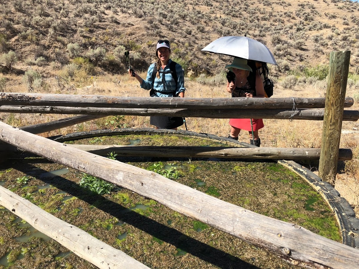
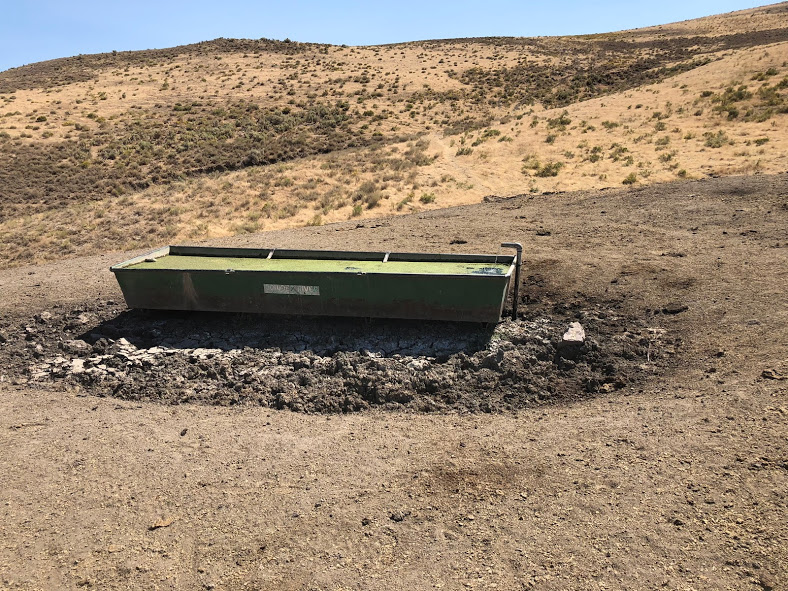
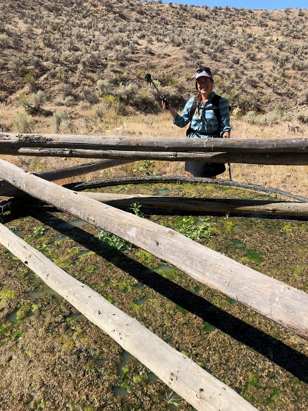
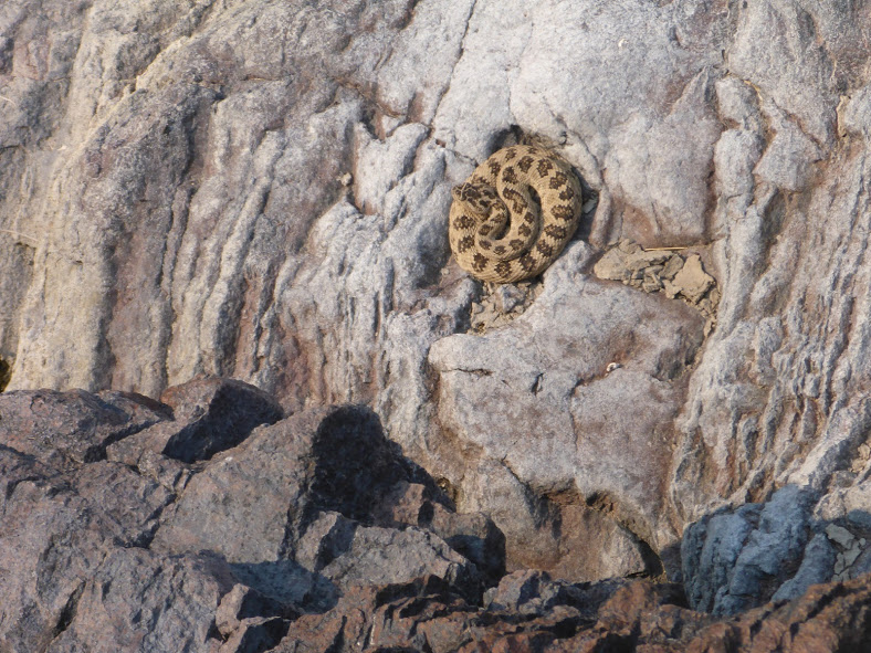
Like most desert ecosystems, the ODT is harsh. There are many pokey things, as well as venomous fauna like scorpions and rattlesnakes (we saw 13). The biggest challeng,e however is water. Water sources may include streams or springs, but more often include cow tanks. Having reliable water treatment as well as a backup method is a good idea. For example, carrying a filter plus Aquatabs, in case your filter breaks (as mine did) or freezes. This is not the trail to test your luck with not treating water.

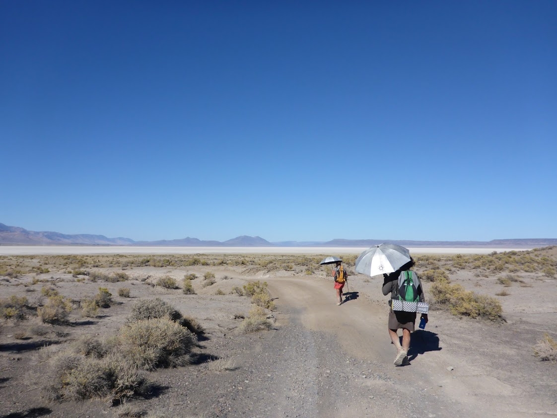
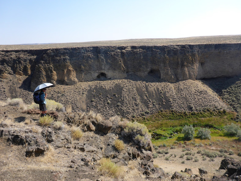
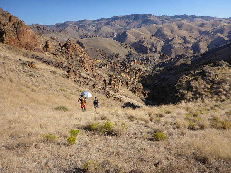
Because sources can be as far as 40 miles apart, I’d recommend a ten- to 12-liter carrying capacity. Keep in mind that these can be challenging cross-country miles with very little shade. On that note, a sun umbrella can also be incredibly helpful for creating your own personal shade.

Finally, while you certainly could hike this trail with only map and compass, I found having a GPS in addition to my paper maps made for more accurate and efficient navigation.

Camping

abert rim

As long as you’re not on private land, which is something to stay aware of on the ODT, you can essentially camp wherever you’d like. As expected, there are no shelters, and the route does not travel through any fee areas.

Oregon Desert Trail Highlights

crack in the ground

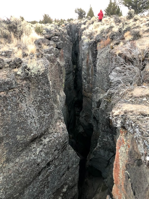
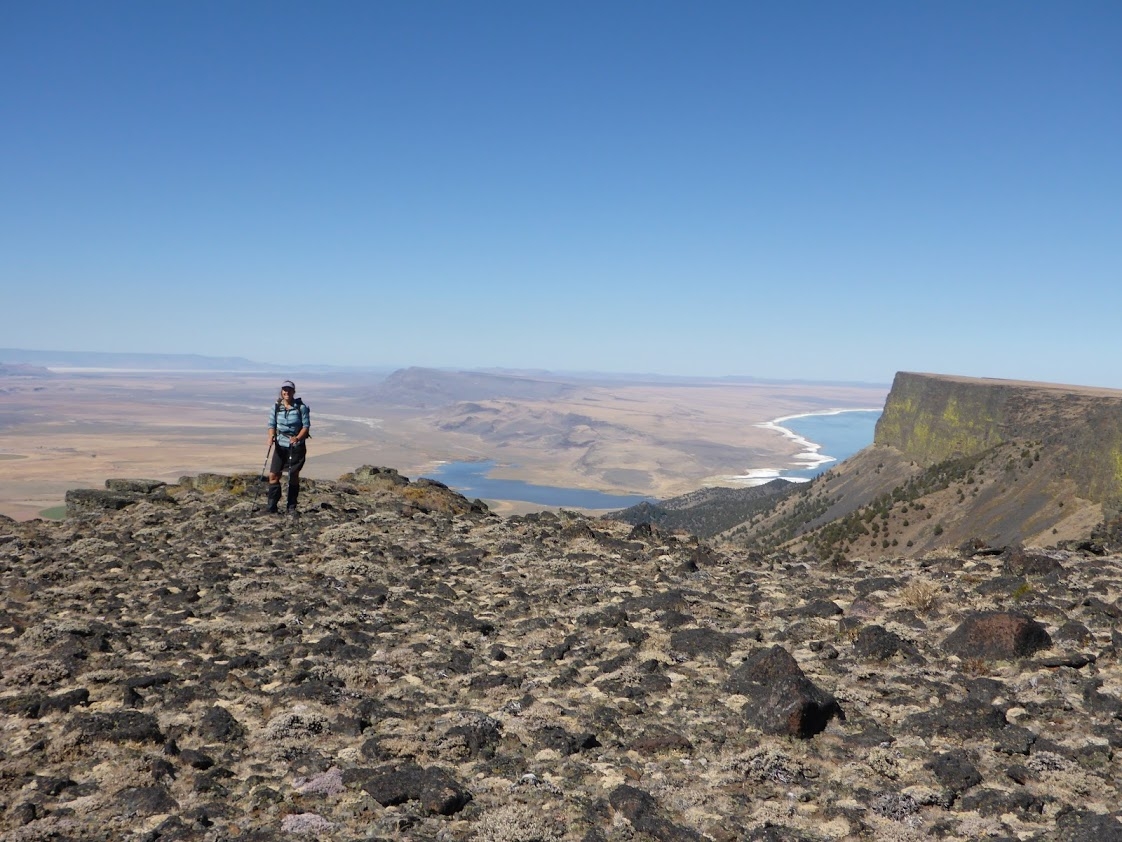
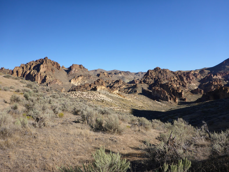
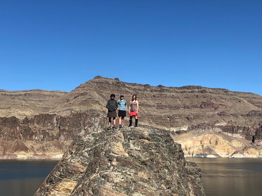
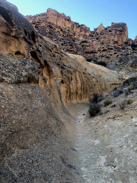
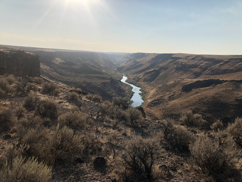
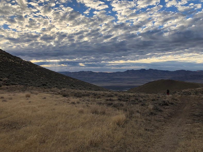
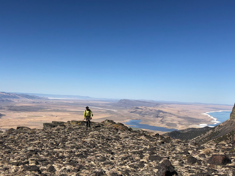
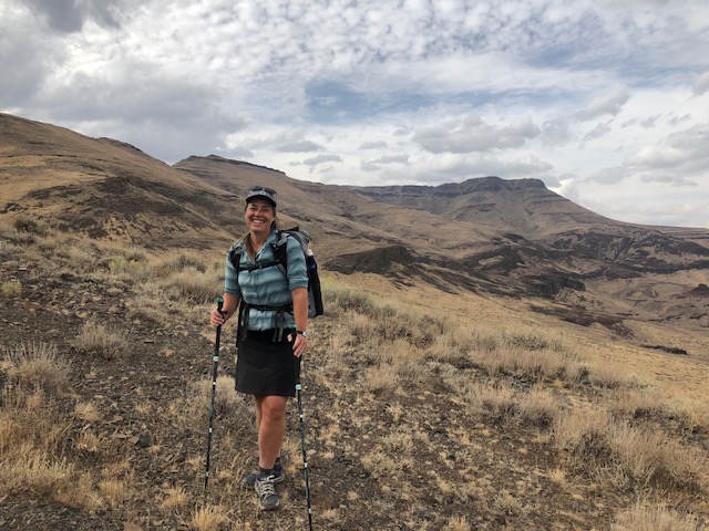
The ODT was much more diverse than I expected. In addition to the hot springs mentioned earlier, some standout sections include Steens Mountain, the Alvord Desert, and Hart Mountain Antelope Refuge. The trail also passes by petroglyphs as well as several fascinating volcanic features, like Crack-in-the-Ground.
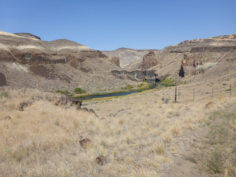
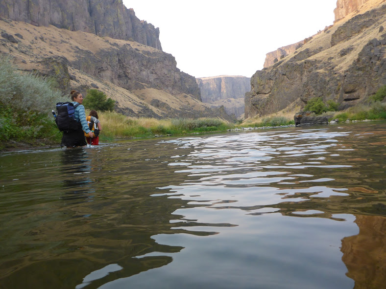
Water Sources

Water is the crux of the route. When I hiked in 2018, the region experienced one of the hottest and driest summers on record, making water during our fall hike a challenge. At one point, we each carried three gallons (that’s 24 pounds!). Sources range from streams to lakes to springs to cow tanks. Some are clear, many are murky.

The most valuable resource for water on the ODT is the water report hosted on ONDA’s website. It’s a Google spreadsheet, so hikers are able to make notes in the field and it syncs once you’re back on Wi-Fi. Sources are ranked as unreliable, questionable, and reliable, and the report contains notes from the current year as well as past years. This was incredibly helpful as we found 2018 more closely matched with 2015 in terms of which sources we could expect to be reliable. We never counted on a source that wasn’t labeled reliable.

Most hikers will also want to cache water in the western 160 miles of trail. ONDA may be able to assist with this for a $10 donation. More details are found on the ‘Water’ tab of the Trail Resources page.

Resupply Options

oregon desert trail water

The trail travels through or near 16 communities, allowing hikers to resupply often. Many of the towns are on trail or only require a short (<10 mile) hitch. ONDA offers an extensive town guide to help with resupply planning.

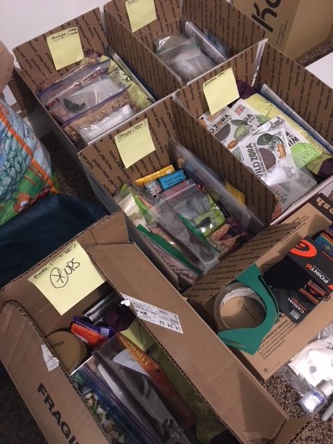
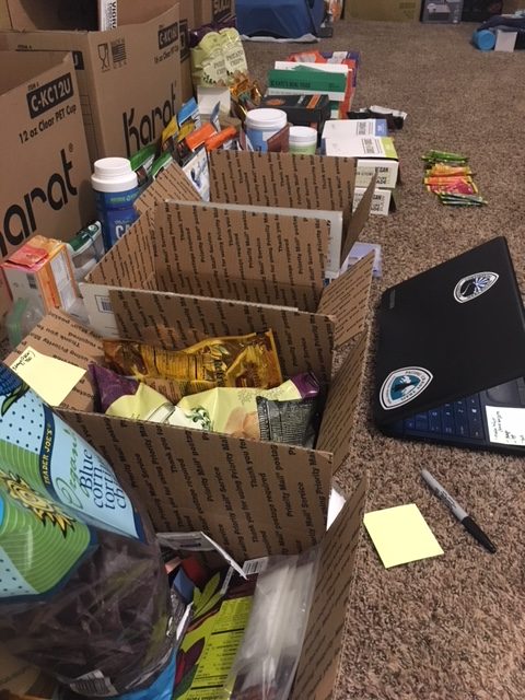
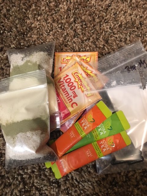
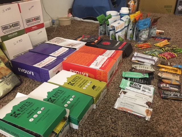
Several of the towns are quite small, with limited or expensive options, so it’s helpful to send boxes.  In terms of food, you can see where and how I resupplied here, which includes where, what, and how much food I sent. I mostly mailed myself boxes and regretted the stops where I didn’t. Here’s how I approached creating a healthy resupply in a remote town with limited options.

Small, remote towns also mean you need to be more self-sufficient in your packing than you would on more well-populated routes. Be prepared for something to go wrong. For example, when my phone died on day three, there was no Apple store anywhere within hundreds of miles, let alone in the next resupply town. Without GPS, having paper maps and compass was essential. Also, do not expect many gear stores, so carry what you need or send it to yourself in advance.

The upside of all this is that the ODT was for sure, mile for mile, the cheapest trail I’ve ever hiked. With only two hotel stays, a few restaurant meals, and no reason to linger in towns, it’s hard to blow a bunch of money even if you’re trying. 

Closing Thoughts

ODT sunset

The ODT is a remote and challenging route for experienced hikers (after all, you have to sign a waiver to access planning materials on ONDA’s site). The landscape is diverse and rewarding, and those night skies and hot springs can’t be beat.

The ODT is also unique because of ONDA’s focus on conservation through responsible use. Furthermore, trail coordinator Renee “She-ra” Patrick is a thru-hiker, and she’s done an impressive job creating a wealth of resources for anyone planning an ODT hike.

For a trip report and more planning resources, including a free resupply planning template, find more at my website and on my hiking partner’s website.

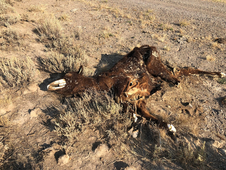
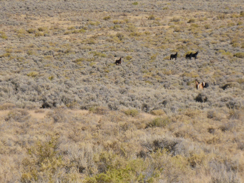
Oh, and expect to see a lot of cows.

Oregon Desert Trail Overview

oregon desert tral

Oregon Desert Trail Overview

In the fall of 2018, I hiked the Oregon Desert Trail west-bound. I deeply enjoyed the vast open expanses and the lonesome nature of this route. I highly recommend it to other hikers, with advanced skill sets, who enjoy remote desert hiking. The present post is more of an overview of the trail, while this other post contains more photos and a few notes from my trail journal.

oregon desert trail

Distance & Location

The Oregon Desert Trail (ODT) is a 750-mile route through the high desert country of eastern Oregon. In the shape of a weird “W”, it’s made up of a network of trails, cross country travel, and two-track dirt roads. The termini are located in the Oregon Badlands Wilderness near Bend, Oregon, and in Lake Owyhee State Park, near the Idaho border.

oregeon desert trail xc

Terrain & Scenery

The ODT was developed by the Oregon Natural Desert Association as a means to promote conservation of Oregon’s spectacular high desert through low impact recreation. The trail traverses key natural areas including Hart Mountain National Antelope Refuge, Steens Mountain, Abert and Diablo Rims, and the Owyhee Canyonlands.

From ONDA’s website:

“To craft this 750-mile route located on public land and public rights-of-way, ONDA stitched existing trails, old Jeep tracks, and historical wagon roads together with stretches of cross-country travel. Our aims are to improve access to the wonders of the desert and to let explorers take a choose-your-own-adventure approach to getting to know this region.

Sections of the trail can be explored on foot or on horseback, or by boat, bike, or even skis in the winter. Some sections offer easy walks along well-marked paths. Other areas require GPS skills, significant outdoor experience, and serious preparation, particularly for water sources.”

odt sunset

I believe that interacting with a landscape is the best way to form a relationship with that land and to care about protecting it. Most of us no longer spend our entire lives on one piece of land, or even in one geographical region. We therefore lack the strong connection to a place that comes from depending on a land for your food and water, building materials, etc.

Recreating in a place for an extended time period is one of the closest proxies we have to that relationship in modern times. Rather than closing off a wild space, allowing people only to be spectators, such as in a museum, we can create corridors of travel where people can connect with a landscape by being immersed in it for days, weeks, or months.

The best resource for hikers wishing to complete the ODT is ONDA’s website. The trail coordinator for the ODT, Renee Patrick, is an experienced thru-hiker, and the resources she’s created and compiled for the trail in just a few years is incredible. You’ll find GPS data, town guides, a water report, trail conditions, and much more.

oregon desert trail jordan canyon

Weather & Climate

Most ODT hikes are completed in the spring or fall. Each option has its own unique challenges and considerations. For example, water is more likely to be available in the spring than in the fall. However, if you start late enough, the fall is likely to be cooler. I also just find autumn to be a very pleasant time to be in the desert.

We completed our ODT thru-hike from September 1-30. The first week, daytime temperatures were in the high 80s and low 90s, but cooled down to high 50s and mid 60s later in the hike. Our nighttime temps ranged from low 20s to mid 40s. The only rain we experienced was a brief shower our last morning on trail. This meant I was able to cowboy camp every single night of the hike 🙂

oregon desert trail water

Water & Resupply Options

Water was one of our biggest challenges. 2018 was one of the hottest and driest years on record in Oregon. The water report, a Google spreadsheet, is found on ONDA’s website and is updated by hikers. You can make notes directly on the spreadsheet in the field and it will automatically update the master spreadsheet when you get to WiFi.

Notes from previous years are in the document and we found the data from 2015, another dry year, most closely reflected what we could expect in terms of reliability for water sources. We never counted on a source unless it was labeled ‘Reliable’, and more than once we found ourselves carrying up to 3 gallons.  If we came upon water before we expected, it was a bonus. Sources include creeks, rivers, springs, reservoirs, and most often, cow tanks. Some were clear and delicious. Others were murky, covered in algae, and tasted very cow-y despite being filtered and chemically treated. Any water is good water in the desert.

The towns and communities along the ODT corridor are all pretty small. They have limited amenities. Partially due to lack of services, and partially due to arriving and departing at odd hours of the day, we were only able to shower twice and do laundry once the entire time. We washed our bodies and clothes on trail, where possible, but it was a very dusty, smelly, and salty 30 days overall. We used blue sponges and a small amount of water in a gallon ziploc bag each night to get the bulk of the grime off our legs before bed. This massively improved comfort, reduced foot issues, and kept sleeping bags at least moderately clean.

Small towns also require you to be more self-sufficient in your packing than you would on more well-populated routes. This means carrying a few more supplies and being prepared for something to go wrong. For example, when my phone died on day 3, there was no Apple store anywhere within hundreds of miles, let alone in the next resupply town. Without GPS, having paper maps and compass was essential. Further, you couldn’t expect gear, such as new shoes or a tent, to be available in towns. You need to send it to yourself. It’s not a big deal-you just need to think ahead, be creative with problem solving, and be flexible.

Also due to the remoteness of the route, and the small town sizes, food and resupply options are limited and often pricey. You can see more about where and how I resupplied here. I mostly mailed myself boxes and regretted the stops where I didn’t. Here’s how I approached creating a healthy-ish resupply in a remote town with limited options.

The upside of all this is that the ODT was for sure, mile for mile, the cheapest trail I’ve ever hiked. With only 2 hotel stays, a few restaurant meals, and no reason to linger in towns, it’s hard to blow a bunch of money even if you’re trying. Another upside of the ODT is that the route either goes directly through towns or very close, so there is very little hitching necessary.

odt trio

Trail Journal

I have an (almost) daily practice of journaling, whether on trail or off. See a few ODT journal excerpts here as well as many more photos.

Additional Resources

Want to stay in the loop? To be the first to know when new posts are published, subscribe to our newsletter here

Oregon Desert Trail Journal

Field Notes (but mostly photos)

I have an (almost) daily habit of journaling, whether on trail or off. My journals are less of a play by play trip guide (“we hiked X miles to Y canyon, which is part of Z wilderness…”), and more of a free-flowing reflection on my inner experience. It’s a way for me to process the moments, the days, the feelings that make up this bizarre experience called life.

In the fall of 2018, I hiked the Oregon Desert Trail westbound, with 2 hiking partners. See this post for an overview of the trip. The present post is mostly a photo essay to provide a visual representation of the ODT, loosely in chronological order, with a few random notes from my trail journal mixed in. I hope it gives you insight into how diverse and stunning this landscape is.

oregon desert trail

“We dropped down into the aptly named Painted Canyon. Cool early morning hiking. A million shades of rocks. Bruise purple, juniper berry blue, sage green, burnt orange, sun-baked-bone white. The canyon walls pockmarked with thousands of tiny caves.

The sunrise touched the tips of the surrounding rock as we continued down the wash, hopping and picking our way over water-smoothed rocks. ….The terrain opened up, the canyon walls become tall grassy hillsides on either side of us. Spires of rust-colored rock jutting out of yellow grass.”

“Once the sun is up, the day becomes unbearably hot very quickly. We realize we’ve miscalculated our mileage to the next reliable water. We come upon a horse trough. It’s full of water covered in algae. We remove the scum to unveil cool murky brown water. Grateful, we drink.”

odt water

“Up one wash after another, cheatgrass filling my shoes and socks. Several carcasses and piles of bones scattered about. The remains of a desiccated snake.”

“We continue on, hiking cross country, up drainages and canyons. We round a bend, and a quarter mile in front of us, a wild horse stares back in our direction. We approach slowly. With surprising grace, it swiftly climbs the hillside and disappears behind a rock outcropping.”

odt

“Many people don’t understand why you’d want to go on a desert hike. ‘Isn’t it lonely out there? Barren?’

There are mule deer and horses and lizards and snakes and hawks and coyotes and sages and thistles and wildflowers and rabbit brush and juniper and just so much life out here. How could one get lonely in the desert?”

“My legs were scratched to pieces and burnt with heat rash, and my shoes and socks were filled with sharp cheatgrass, but the moment I stepped into the rushing Owyhee, all the aches melted and everything, yet again, was okay. The current was swift and I held tight to some rocks underwater. It’s difficult to describe how glorious a dip in the river feels to a dust-caked, sun-soaked desert walker.”

owyhee


odt trio

“Despite the rough day, I’m grateful to be out here. Grateful to walk. Grateful for incredible hiking partners to laugh and suffer with. Grateful for a strong body. Trail (and life) will always bring challenges. It’s up to us how we perceive and handle them.”

odt river

“We walked dirt roads for 8 hours today. The landscape went on forever. You reach the top of a small rise and the scene resets, road and sage on into infinity. Dust devils danced in the wind. Heat waves rose from the ground. So much space for the mind to wander.

At lunch, we create personal shade patches by propping our umbrellas on sage bushes and scrunching underneath. We kept imagining we saw shade trees in the distance, but they all turned out to be weird shaped rocks or just more sage.”

“The fine dust lent itself well to telling the desert’s story. I could detect the tracks of so many different animals and invented a whole narrative in my mind. The snake, the giant millipede, the mouse, the antelope, the coyote, the jackrabbit… So many creatures have traveled here before me. People think the desert is lonely. I have to laugh. ”

“Up at 4:30 and hiking by 5 under a crescent moon and starry milky way. We walk directly east into the soon-to-be rising sun. The light filters rose, purple, orange through the clouds. Walking along the canyon rim, we make good miles on old jeep roads before the sun climbs too high in sky. Jack rabbits dart from one sage bush to the next.”

“Within a few miles, we’re forced into the river to make our way forward. The walls of the canyon are rocky and steep and the small bank that comes and goes on either side is full of willows, grasses, briers, hackberry trees, sage bushes, and massive boulders. Canyon travel is difficult and we move at 1-1.5 mph.

I’m swimming towards some large red boulders on the opposite bank, determining how I’m going to get up out of the water and onto the rock. I begin to pull myself up, eye level with the top of the boulder. I look up, searching for my next hand hold  and spot a rattlesnake about 3 feet from my face. It doesn’t rattle. It begins to slither away, then stops, flicks it’s tongue, and coils into strike position.”

“We stop for a break at a bend in the canyon. In one of the most wild and remote regions of the country, it’s unbelievably silent…. As we pack up to move on, I hear what sounds like a jet coming around the canyon wall, and swooooosh, a flock of grouse is flying directly at our heads. They head straight for us, not veering up until the last moment. We whip our heads to follow their path, and as quickly as they appeared, they had flown out of sight. “

“We hike across the playa of the Alvord desert, a 12-by-7-mile dry lake bed. Mountains in every direction. Steens Mountain, which we will climb 5,000′ up and over tomorrow, is in the foreground.”

“I rolled my ankle in the Pueblos yesterday and it’s throbbing now. We make it to the hot springs by dusk. We snack and soak and rinse our clothes and linger until our skin is pruny. It’s glorious.”

“This type of travel requires you to constantly be on; to be flexible and adaptable. You might find cow trail to follow for a few hundred yards until it peters out, or you get cliffed out, and you have to let go, and find the next path of travel until that peters out or you realize you’re off your trajectory, and then you adjust again. Constantly changing your plan, experimenting, trying, failing, and not getting frustrated in the process. Good practice for navigating life.”

“The Hart Mountain Antelope Refuge is beautiful. Easy walking along rolling hills covered in sage brush, groves of aspen, and lone junipers. We’ve seen several herds of antelope. The aspens are golden-orange-yellow-bright green. I’m grateful for this taste of fall on the autumnal equinox. We descend down to Hart Lake and pass several boulders covered in petroglyphs. ”

“The rocks here are diverse and beautiful. And sometimes painful. Lava rock strewn everywhere, including all throughout the fields of sage and cheatgrass we traverse. There’s obsidian, opal, quartz, and many more whose names I don’t know. Remnants of the region’s volcanic history.”

“I wake up to the sounds of coyotes howling again. This morning, the twilight is a lovely red glow as we climb up to a ridge. We’re up high on single track (an ODT luxury). The nearly full moon is a big orange Harvest moon setting in the valley. We crest a mountain just as the sun rises and treats us to spectacular views of the Warner mountains in all directions.”

“This trail was a time warp. 30 days felt like 4 months. I didn’t come with many expectations. I just wanted adventure. The diversity and beauty of this landscape has amazed me. Much more than miles of sage, this area holds true remoteness and hidden gems. We’ve walked 700+ miles through one of the most remote regions of the US, in one of the hottest and driest seasons on record. We didn’t see a single other hiker. We laughed a lot and never passed up a chance for shenanigans. It wasn’t a relaxing month-not by any stretch of the imagination. But it provided the space and freedom and challenge I needed. It slowed me down. It was a salve to my irritated soul.”

“Ahh, to walk all day. To explore the limits of the body and the mind. What a blessing.”

How to Create a Healthy Resupply in a Tiny Town

oregon desert trail

What to Eat When the Healthy Choices are Non-existent or Obscure

Let’s start with a quick story of an experience I had like this on the Oregon Desert Trail. We had just walked the remaining 7 miles into McDermitt, NV, arriving around 8am for what would be the closest day we’d have to a zero on this 750-mile route through the very sparsely populated region of eastern Oregon.

It’d been 10 days of 90-degree dusty desert hiking since we’d had a shower, and 6 days since we’d had any meals other than backpacking food. I was jonesing for some vegetables. I’d been dreaming of a big bowl of dark leafy greens with tomatoes, beets, walnuts, avocado, olive oil, and balsamic vinegar.

Alas, as much as I’d prayed to the desert gods for some real, healthy food, I knew I wasn’t going to find it here. McD is a ranching, farming, and mining town that straddles the NV/OR border. It consists of a motel, a cafe/casino, a PO, a high school, and an all-in-one gas station/market/convenience store. This was one of the few places I didn’t mail myself a resupply box on the ODT and I was immediately regretting it.

tiny town resupply
Veggies were sparse in McDermitt, NV.

After our first (of four) meals at the Say When Casino and Cafe, it was time to create our resupply for the next 5 days. We walked into the small gas station/market/c-store and I saw about 8 rows of packaged foods, some coolers of soda and beer, and a small stand of “fresh” produce (Hey, at least there’s some produce at all!). Time to get creative.

There are many such towns from which you may have to resupply, especially if you are going to hike any trails or routes off the beaten path. And especially if you decide to hike in one of the most remote regions of the country.

convenience store

How to Approach Eating for Optimal Health and Energy in a Tiny Town C-Store

First, accept that you’ll have to make some compromises, but don’t give up on the goal of healthy eating entirely! It may all look like junk, but some choices are better than others here. Let’s look more closely.

Don’t make the process overwhelming. The process is simple.

  • Make Your List

Until you get the hang of what items you need for a healthy resupply, and before going into the store, write a short list of ideas for breakfast/lunch/dinner/snacks/beverages. For efficiency and cost, choose items that can be used in multiple ways for different meals (like corn chips you’ll eat with PB for lunch and again with beans for dinner OR trail mix that can be added to oatmeal for breakfast or used as a stand alone snack). Keep your list general: nut butter, salami, breakfast bars, oatmeal, nut butter, etc. Be sure to have a mixture of flavors and textures as well as macronutrients (aiming for about 20% protein, 40% fat, 40% carb-or whatever feels best for your body).

  • Choose Your Food

Browse the shelves. When you see an item from your list, you’ll likely see multiple different varieties (chips/pb/trail mixes/etc). Which to choose? Look at the ingredient label. You are looking for the least number of ingredients possible. You are also looking to avoid added industrial oils, preservatives, food colorings, and high fructose corn syrup when possible. Unfortunately, it’s not always possible in these tiny stores, but do your best. You are also looking for items in their most whole food/least processed form. Focus on proteins, healthy fats (olive oil, avocados, coconut oil, nuts), and low sugar carbs.

If there is a produce section, look for the freshest (not wilted or bruised), most nutrient-dense items to either pack out or eat before leaving town. Amazingly, many of these tiny places sell avocados (great for potassium, fiber, antioxidants). Bags of spinach or carrots are also widely available and easy to pack out.

  • Calculate Your Calories

Before leaving the store, use your phone calculator to quickly get an estimate of the calories. This takes less than 5 minutes and can help you avoid overspending on (and carrying) food you don’t need and/or assure you that you have enough if you’re feeling uncertain.

For the amount of calories you need each day, that will take a bit of experimentation, but use this calculator (or something similar) to get in the ballpark, and adjust from there depending on terrain, climate, and whether you’re losing a bunch of weight or not. Add up the calories in your basket and divide by the number of days you plan to be out. Voila. If you want to go above and beyond, calculate your macros to be sure you have the right ratios of fat, protein, and carbs. This would likely be easiest by entering the foods into a free app, such as MyFitnessPal.

tiny town healthy resupply

What I Chose in McD for my 5-Day Resupply

My calorie goal for 5 days early in the trip was about 11,500, or 2,300 per day. Here’s what I found in the convenience store. A couple items, where noted, were leftover from my last box, but these calories could have been substituted with other bars or trail mix or another avocado from the c-store.

1 lb bag Tortilla Chips=1500 calories

1 lb whole carrots=150 calories

1 large avocado=300 calories

1 apple=100 calories

Dehydrated Refried Beans=300 calories

2 Coconut Oil packets (leftover from my last resupply)=240 calories

3 coconut-greens-collagen smoothie mixes (leftover from last resupply)=600 calories

3 Kates/Fourpoints bars (leftover from last resupply)=900 calories

3 Granola packets (leftover from last resupply)=750 calories

4 tuna pouches=300 calories

1 lb peanut butter=2600 calories

3 bags of fruit/seed/nut trail mix=2300 calories

Chocolate Bar=600 calories

Pepperoni=800 calories

Salami=700 calories

Electrolyte drink mix=50 calories

Kombucha (drank in town)=80 calories

total= ~12,200 calories

I usually pack just a little bit extra, such as a couple bars, for calories in case I’m hungrier than expected or take longer to reach the next town than expected.

As you can see, it’s not ‘perfect’ in terms of being organic, super high quality food, but it covers my nutritional bases, and it’s far from the typical pop-tarts/snickers/doritos resupply that could be purchased from the same store.

Even when options are limited, you can still make good choices that will fuel you for optimal energy and endurance!

For a deep dive into performance nutrition and meal planning for backpackers, check out our online course on the topic.

Oregon Desert Trail Resupply Planning

ODT resupply

Food Resupply Plan for the Oregon Desert Trail

This post details how I planned my food for the Oregon Desert Trail. I’ll post more on general trail information and planning resources in a separate post. This one is all about where, what, and how much I planned for food resupply for the ODT. I’ll do a follow-up post when I return about how this plan worked out.

Grab a cup of coffee. This is a long one, but hopefully you’ll find it’s jam-packed with useful info.

The following table details where I sent each box, the calorie goals for each day, the specific food I sent, and how that broke down in term of macronutrients (percentages of fat, carbs, and protein), as well as total food weight carried.

The calorie goal for each resupply box is in the top left corner of the table for each location. The actual calories in the box are at the bottom of the table for each section, which is also where you’ll find the macro breakdown and the food weight of the box.

ODT resupply

Determining Goal Calorie Intake

I loosely track daily calories and nutrients with the app MyFitnessPal. To create my calorie goals, I used that data of my current intake and expenditure, coupled with knowledge from previous hikes.

The numbers may seem low considering that I’m 5’7″, have a normal BMI, and I’ll be hiking 25-30 miles per day. However, I made them low for a couple reasons:  1) I’m still recovering from a hypo-thyroid issue, and the thyroid is the master regulator of metabolism, so my current basal metabolic rate (BMR) is lower than it has been in the past. I know this because I track my calorie intake and weight. While some might consider the downside of this being that ‘I have to’ eat less food to maintain my weight, the upside of a currently lower BMR is that ‘I get to’ eat less food to maintain my weight. That’s convenient when you’re backpacking and you have to carry it all on your back 🙂 And reason 2) The time frame (30 days) is relatively short, so I won’t get into full on hiker hunger, and if I do go into a calorie deficit, it won’t be for long.  You’ll also notice that in each box I include several hundred additional calories above the goal amount, just in case.

Macronutrient Percentages

Let’s start by saying that I strongly believe in bio-individuality. Every body is different. Figure out what works best for you. I mean that in terms of both what your diet is made up of, as well as in terms of calories and macronutrients, and in terms of specific foods you do or do not tolerate well. Food quality and a focus on whole foods is the constant and the details are variable.

I’ve found that I thrive when I eat a diet higher in healthy fats, moderate in protein, and slightly lower in carbs. The numbers in this chart show my diet as generally being 50-60% fat, 10-20% protein, and 30-40% carbohydrate. Off trail, the fat number tends to be higher and the carbs lower, but this is how it settled out for the trail and I’m comfortable with that. We’ll see how I feel.

Also, I’m aware that in the table, the macro percentages don’t always add up to 100%. In a couple spots they add up to 102 or 105%. I believe this is due to averaging values for different varieties/flavors of granola, bars, etc. While this is not ideal, the data is still accurate enough to give a good reflection of what the nutritional spread looks like.

Food Planning on a ‘Restricted Diet’ while Going Stoveless

All foods in this resupply plan are gluten free and dairy free. This list does also not rely heavily on grains or added sugars, though there are a few in there. The focus is on including real foods with either no ingredient list or very short ingredient lists made up of recognizable foods. To avoid toxin exposure, most of these foods are organic.

I firmly believe in doing the best you can, and not obsessing about being perfect. While I’m all for eating a high-quality diet on trail, don’t let the idea overwhelm you to the point where you give up before you start. Start where you’re at and any small improvements you can make in food choices and quality will translate into feeling better on trail and supporting a cleaner environment.

Supplements & Other Items in Each Box

There are a few items that went into each box that aren’t listed in the chart. This includes maps for each section, wet wipes, and supplements. Oh, and resupply baggies of coarse celtic sea salt 🙂

Supplements I’m carrying: Magnesium Citrate Powder to help with muscle relaxation and sleep; Turmeric capsules to reduce overall inflammation; Vitamin C for electrolyte replacement and antioxidants; and probiotics to maintain optimal gut health.  Not a ton, just the basics.

I also have cordyceps mushroom powder in my morning smoothie mix, along with the coconut creamer, collagen, chia, and spices. The cordyceps is for improved oxygen utilization and endurance. The spices, while not necessarily  supplements, serve similar anti inflammatory and medicinal roles.

For a deep dive into performance nutrition and meal planning for backpackers, check out our online course on the topic.

ODT resupply

Specific Brands I Carried

In the table, I left most food descriptions fairly general because I want to convey that in many instances you don’t have to choose one specific brand, and you can often find healthy substitutions that are either more available to you or suit your preferences better. I want the focus to be on the overall quality of the food and the idea that you can fuel a long distance hike with whole foods, made up of real ingredients.

The following are the specific brands I carried on this hike. While some of this food was donated to me, these are all brands I had tried in advance and approve of the ingredients and nutrition profile. Trust me, I wouldn’t be carrying them if I wasn’t certain they would fuel my hike properly. Having gone through adrenal and thyroid issues in the past, I’m well aware that my energy and my body are my greatest asset on any long distance hike.

It’s worth it to me to be thoughtful in my food choices, as well as in what brands I support. I like to feel aligned with the brands behind the products I consume to the extent that I can. This also goes for the gear I purchase.

Laird Superfood Coconut Creamer

Laird Superfood Hydrate Coconut Water

Vital Proteins Collagen Powder

Amazing Grass Greens Powder

Nutiva Chia Seeds

Trader Joe’s Almond Butter

Trader Joe’s Organic Tortilla Chips

Supernola Granola

Gorilly Goods Trail Mix

Wild Zora Meat & Veggie Bar

Trader Joe’s 85% Cocoa Chocolate

Wild Zora Meals

Sante Fe Dehydrated Beans

Natural Grocers Dehydrated Bulk Veggies

Trader Joe’s Individual Coconut Oil Packets

Kate’s Real Food Bars

Four Points Bars

Trail Nuggets

Cusa Premium Organic Instant Tea

If you want ideas for additional foods on my shopping list beyond what’s listed here, download my free Healthy Hiker Grocery Guide here

Without further ado, the data…

calories/serving fat g/serving carb g/serving protein g/serving weight/ serving (grams) servings taken total calories total fat (g) total protein (g) total carbs (g) total weight (g)
Start/eastern terminus (5 days) @ 2000 cal/day = 10000 cal
coffee/tea 0 0 0 0 0 0 0 0 0 0 0
laird superfood creamer 75 3 3 0 4 5 375 15 0 15 20
greens powder, cinnamon, ginger, cordyceps 30 5 7 1 10 5 150 25 5 35 50
collagen powder 70 2.5 1 10 15 5 350 12.5 50 5 75
chia seeds (1 tbl) 60 5 5 3 13 5 300 25 15 25 65
almond butter 190 17 7 7 32 14 2660 238 98 98 448
organic corn tortilla chips 140 8 15 2 28 8.5 1190 68 17 127.5 238
trail mix 200 17 6 12 34 6 1200 102 72 36 204
granola 210 16 14 6 42 4 840 64 24 56 168
bars 260 12 31 10 70 4 1040 48 40 124 280
chocolate 250 20 13 4 2.5 625 50 10 32.5 0
jerky 110 6 10 7 31 4 440 24 28 40 124
beans 130 0 24 7 35 6 780 0 42 144 210
mixed veg 30 1 8 3 13 5 150 5 15 40 65
coconut oil 120 14 0 0 15 4 480 56 0 0 60
spices 0 0 0 0 0 0 0 0 0 0 0
wild zora dinner 310 7 38 35 85 1 310 7 35 38 85
TOTAL 9715 662 381 736 4.20
Calories from F/C/P 5958.00 1524 2944 pounds
Percent of Total 61.33 15.69 30.30
ROME (5.5 days) @ 2200/day =12,000 cal
coffee/tea 0 0 0 0 0 0 0 0 0 0 0
laird superfood creamer 135 3 3 0 4 5 675 15 0 15 20
chia seeds (1 tbl) 60 5 5 3 13 5 300 25 15 25 65
greens powder, cinnamon, ginger, cordyceps 30 5 7 1 10 5 150 25 5 35 50
collagen powder 70 2.5 1 10 15 5 350 12.5 50 5 75
hydrate mix 40 0 10 0 12 9 360 0 0 90 108
0
almond butter 190 17 7 7 32 14 2660 238 98 98 448
organic corn tortilla chips 140 8 15 2 28 8.6 1204 68.8 17.2 129 240.8
granola 200 16 14 6 42 6 1200 96 36 84 252
jerky 110 6 10 7 31 4 440 24 28 40 124
bars 260 12 31 10 70 8 2080 96 80 248 560
trail mix 210 17 6 12 34 6 1260 102 72 36 204
chocolate 250 20 13 4 2.5 625 50 10 32.5 0
0
wild zora dinner 340 2 32 41 85 1 340 2 41 32 85
beans 130 0 24 7 35 6 780 0 42 144 210
mixed veg 30 1 8 3 13 5 150 5 15 40 65
coconut oil 120 14 0 0 15 4 480 56 0 0 60
spices 0 0 0 0 0 0 0 0 0 0 0
TOTAL 13054 815.3 509.2 1053.5 5.73
Calories from F/C/P 7337.70 2036.8 4214 pounds
Percent of Total 56.21 15.60 32.28
(MCDERMITT: BUY IN TOWN)
FIELDS (3 days) @ 2500 cal/day =7500 cal
coffee/tea 0 0 0 0 0 0 0 0 0 0 0
laird superfood creamer 75 3 3 0 4 3 225 9 0 9 12
greens powder, cinnamon, ginger, cordyceps 30 5 7 1 10 3 90 15 3 21 30
collagen powder 70 2.5 1 10 15 3 210 7.5 30 3 45
chia (1 tbl) 60 5 5 3 13 3 180 15 9 15 39
0 0 0 0
almond butter 190 17 7 7 32 14 2660 238 98 98 448
potato chips 140 7 17 2 28 7 980 49 14 119 196
bars 260 12 31 10 70 3 780 36 30 93 210
trail mix 210 17 6 12 34 4 840 68 48 24 136
granola 210 16 14 6 42 2 420 32 12 28 84
jerkey 110 6 10 7 31 3 330 18 21 30 93
0 0 0 0
wild zora meal 310 2 32 41 85 1 310 2 41 32 85
beans 130 0 24 7 35 6 780 0 42 144 210
mixed veg 30 1 8 3 13 5 150 5 15 40 65
coconut oil 120 14 0 0 15 4 480 56 0 0 60
spices 0 0 0 0 0 0 0 0 0 0 0
TOTAL 8435 550.5 363 656 3.82
Calories from F/C/P 4954.50 1452 2624 pounds
Percent of Total 58.74 17.21 31.11
FRENCHGLEN (4 days) @2500 cal/day =10,000 cal
coffee/tea 0 0 0 0 0 0 0 0 0 0 0
laird superfood creamer 75 3 3 0 4 5 375 15 0 15 20
greens powder, cinnamon, ginger, cordyceps 30 5 7 1 10 5 150 25 5 35 50
collagen powder 70 2.5 1 10 15 5 350 12.5 50 5 75
chia (1 tbl) 60 5 5 3 13 5 300 25 15 25 65
0 0 0 0
almond butter 190 17 7 7 32 14 2660 238 98 98 448
potato chips 100 7 17 2 28 10 1000 70 20 170 280
trail mix 210 17 6 12 34 5 1050 85 60 30 170
granola 200 16 14 6 42 4 800 64 24 56 168
bars 250 12 31 10 70 8 2000 96 80 248 560
chocolate 250 20 13 4 2.5 625 50 10 32.5 0
jerky 110 6 10 7 31 3 330 18 21 30 93
0 0 0 0
wild zora dinner 370 8 33 36 85 1 370 8 36 33 85
beans 130 0 24 7 35 6 780 0 42 144 210
mixed veg 30 1 8 3 13 5 150 5 15 40 65
coconut oil 120 14 0 0 15 4 480 56 0 0 60
spices 0 0 0 0 0 0 0 0 0 0 0
TOTAL 11420 767.5 476 961.5 5.24
Calories from F/C/P 6907.50 1904 3846 pounds
Percent of Total 60.49 16.67 33.68
PLUSH (2 days) @ 2500 cal/day = 5000 cal
coffee/tea 0 0 0 0 0 0 0 0 0 0 0
laird superfood creamer 75 3 3 0 4 5 375 15 0 15 20
greens powder, cinnamon, ginger, cordyceps 30 5 7 1 10 5 150 25 5 35 50
collagen powder 70 2.5 1 10 15 5 350 12.5 50 5 75
chia (1 tbl) 60 5 5 3 13 5 300 25 15 25 65
0 0 0 0
wild zora breakfast 520 36 43 10 92 1 520 36 10 43 92
trail mix 210 17 6 12 34 4 840 68 48 24 136
granola 200 16 14 6 42 4 800 64 24 56 168
bars 250 12 31 10 70 10 2500 120 100 310 700
jerky 110 2 220 0 0 0 0
nut butter 180 14 8 9 32 1 180 14 9 8 32
wild zora dinner 370 8 33 36 85 1 370 8 36 33 85
TOTAL 6605 387.5 297 554 3.18
Calories from F/C/P 3487.50 1188 2216 pounds
Percent of Total 52.80 17.99 33.55
(LAKEVIEW: BUY IN TOWN)
PAISLEY (2 days) @ 2500 cal/day = 5000 cal
coffee/tea 0 0 0 0 0 0 0 0 0 0 0
laird superfood creamer 75 3 3 0 4 5 375 15 0 15 20
greens powder, cinnamon, ginger, cordyceps 30 5 7 1 10 5 150 25 5 35 50
collagen powder 70 2.5 1 10 15 5 350 12.5 50 5 75
choc coconut creamer 35 1 2 0 3 12 420 12 0 24 36
wild zora breakfast 520 38 40 11 92 1 520 38 11 40 92
trail mix 200 17 6 12 34 4 800 68 48 24 136
granola 200 16 14 6 42 4 800 64 24 56 168
bars 260 12 31 10 70 10 2600 120 100 310 700
jerkey 110 6 10 7 31 2 220 12 14 20 62
wild zora dinner 340 7 38 35 85 1 340 7 35 38 85
TOTAL 6575 373.5 287 567 3.18
Calories from F/C/P 3361.50 1148 2268 pounds
Percent of Total 51.13 17.46 34.49
CHRISTMAS VALLEY (4 days) @ 2500 cal/day=10,000
coffee/tea 0 0 0 0 0 0 0 0 0 0 0
laird superfood creamer 75 3 3 0 4 5 375 15 0 15 20
greens powder, cinnamon, ginger, cordyceps 30 5 7 1 10 5 150 25 5 35 50
collagen powder 70 2.5 1 10 15 5 350 12.5 50 5 75
choc coconut creamer 35 1 2 0 3 12 420 12 0 24 36
almond butter 190 17 7 7 32 14 2660 238 98 98 448
potato chips 100 7 17 2 28 10 1000 70 20 170 280
trail mix 200 17 6 12 34 6 1200 102 72 36 204
bars 260 12 31 10 70 7 1820 84 70 217 490
chocolate 250 20 13 4 2.5 625 50 10 32.5 0
jerky 110 6 10 7 31 5 550 30 35 50 155
beans 130 0 24 7 35 6 780 0 42 144 210
mixed veg 30 1 8 3 13 5 150 5 15 40 65
coconut oil 120 14 0 0 15 4 480 56 0 0 60
spices 0 0 0 0 0 0 0 0 0 0 0
TOTAL 9685 647 362 811.5 4.35
Calories from F/C/P 5823.00 1448 3246 pounds
Percent of Total 60.12 14.95 33.52

Despite my best efforts, this chart is a bit difficult to read. For a copy of the chart, as well as a template for your own resupply planning, click here: ODT resupply.

Questions? Post them in the comments below.

Need help planning your own resupply? Learn more here.