Prologue
One of the things I value most about the time I spend outdoors is the lessons I learn about myself, life, and human nature. Whenever I find myself repeatedly ruminating about something at 3 AM, I know there’s something there for me to explore more deeply. This is a story about a weeklong trip I took this spring in the Grand Canyon and how that helped me uncover lessons about my own fear of being the “weakest link” on an expedition, my relationship with perfectionism, and how that ultimately led to greater self-awareness and choice in how I want to show up in the future. In short, this is a reflection on who we get to become when we challenge ourselves outdoors, especially in a team setting.
Before I even realized what was happening, the river caught the edge of my boat, grabbed the bow, and in slow motion I watched the front of my boat flip back on top of me. I was suddenly fully submerged in the 50-degree Colorado River, floating quickly downstream. My worst fear; the nightmare that had woken me up (more than once) at 3 AM in the months preceding the trip had materialized.
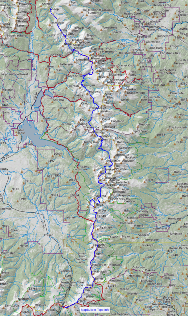
The circumstances leading up to this moment started five months prior when I received a trip invite for a weeklong backpacking, canyoneering, and packrafting trip in the Grand Canyon. It was billed as being fast-paced and challenging, full of early starts and long days. We would have fun, but we also needed to move efficiently to cover the proposed itinerary. Perfect! This was the type of trip I’d been wanting to take as I started building my canyoneering skills a few years ago, and my packrafting skills just a few months prior.
I mentally assessed my readiness. The off-trail backpacking would be no problem (as far as any Grand Canyon foot travel can be described as such). The canyoneering portion would be tough, but I felt comfortable with what we had planned, especially with this team. The packrafting section was longer and more challenging than any of the short, flatwater trips I’d done before. This made me nervous, but I had five months to prepare. No problem. I excitedly confirmed my spot.
In the months leading up to the trip, I ordered any remaining gear I needed, kept myself physically fit, and studied the route. All this got me excited for the main event, but my concerns over the packrafting section continued to loom heavy in my mind. I found myself waking up at 3 AM, ruminating on worst case scenarios like flipping my boat, losing my paddle and pack down river, and my team needing to rescue me. I would toss and turn until dawn, finally getting out of bed with an anxious pit in my stomach. Maybe I’m not ready, I’d think. Maybe I should cancel.
But I really love the Grand Canyon and I wanted to do this trip. Knowing that preparing as much as possible was my best hope at improving my confidence and quieting the inner critic, I practiced my knots, watched video tutorials, read books, rafted on my local river, and even arranged a weekend of boating practice in the Grand with the trip lead. We used whitewater boats rather than the ultralight boats we’d have on the trip, but it was still a good confidence booster.
All of this quieted the voice, but it didn’t silence it. I was excited for the trip and knew it wouldn’t be catastrophic, but I still felt anxious. I could recognize how much mental energy I was wasting by allowing this uneasiness. This was unlike me. What was really at the root of this?
As I do, I journaled it out. I was the least experienced canyoneer and packrafter of the group. As a guide and person who’s been recreating outdoors for over two decades, I was not used to being the “beginner” of a group. Reflecting more deeply, attempting to define my nebulous anxieties, I realized I had tied my self worth to my skillset. And I uncovered a deep seated discomfort with the thought of being the weakest link, of slowing my team down, of needing to ask for help. I wanted to be a contributing member of the expedition, not an anchor, and I questioned whether I was bringing any value to the expedition. Logically, I knew that I was, but still I found it hard to genuinely reassure myself.
Finally the week of the trip arrived. I was ready to just get going. I hoped that, as with previous trips, once we started moving, the worries would fall away. I’m as prepared as I’m going to be. Let’s do this!
Day 1: Dropping In
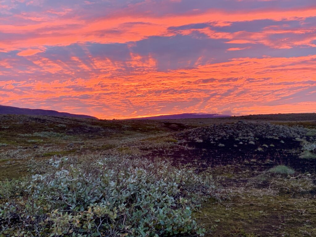
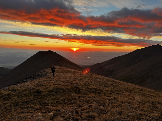
With a full day ahead, we planned to start at daybreak. I slept fitfully, as expected after a full day of driving and late night of gear organizing. I warmed up enough water for extra coffee and watched as dawn light draped the Western Grand. I love this place, I thought, and I’m psyched to spend the next 7 days here with an awesome team. A tinge of uneasiness remained, concerned I was out of place, but mostly I was eager to embark on the adventure.
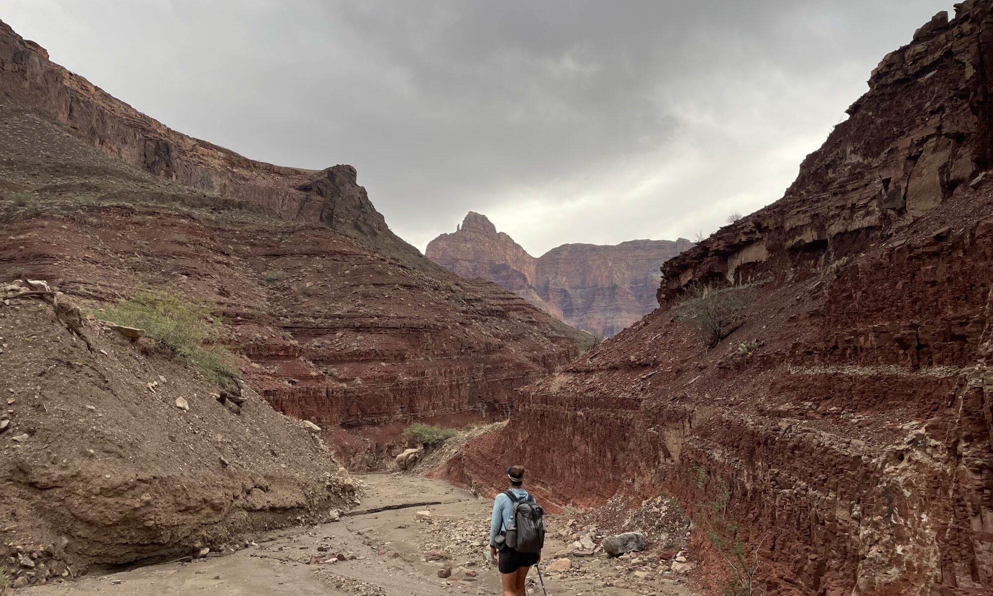
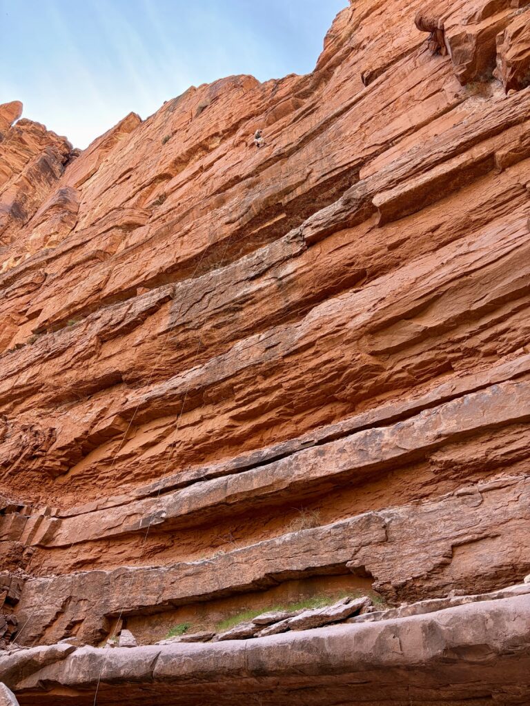
After a brief walk to the rim, the excitement started quickly with a 100’ rappel to break the Kaibab. Temperatures were expected to be unseasonably warm this week and already, at 8 AM, the sun baked the landscape as we continued our descent down steep chossy slopes to the head of the canyon that would take us to the river.
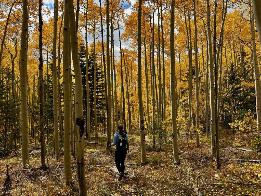
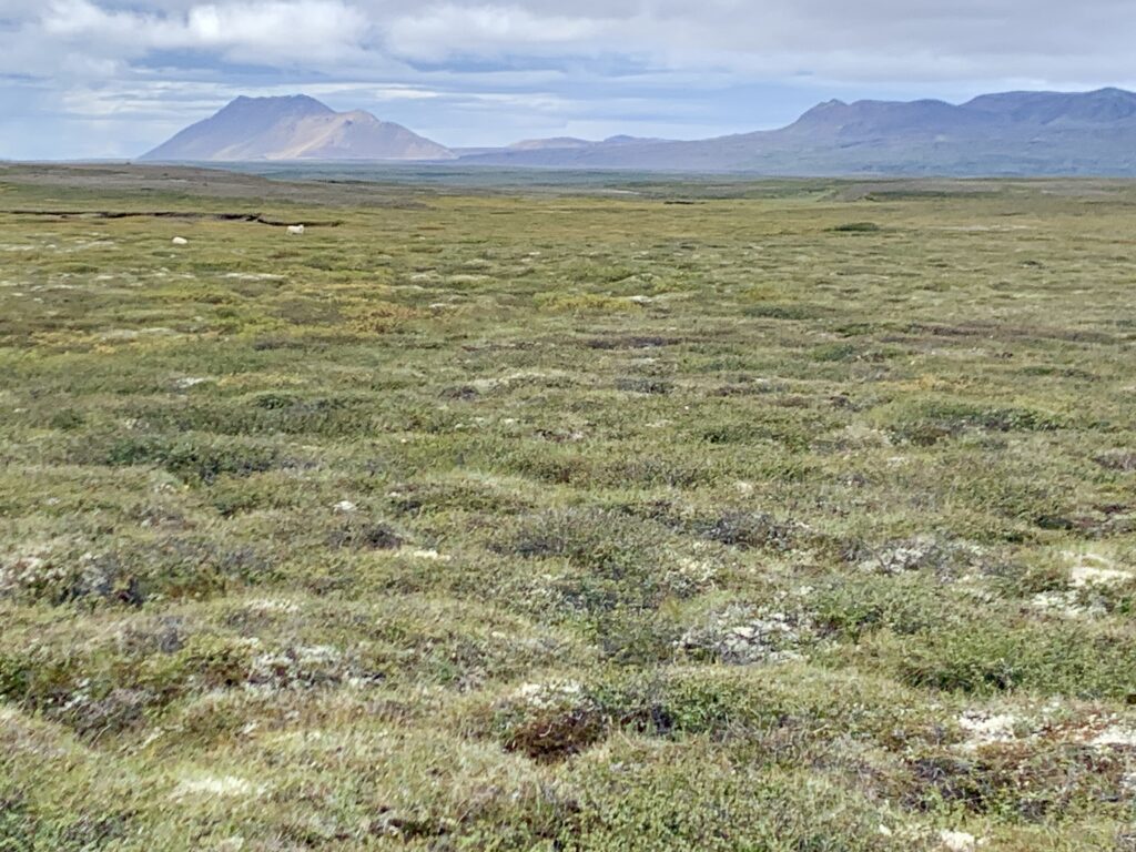
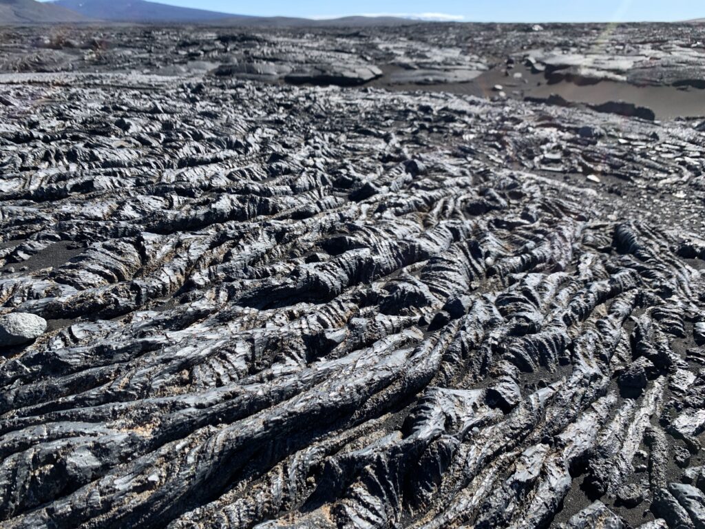
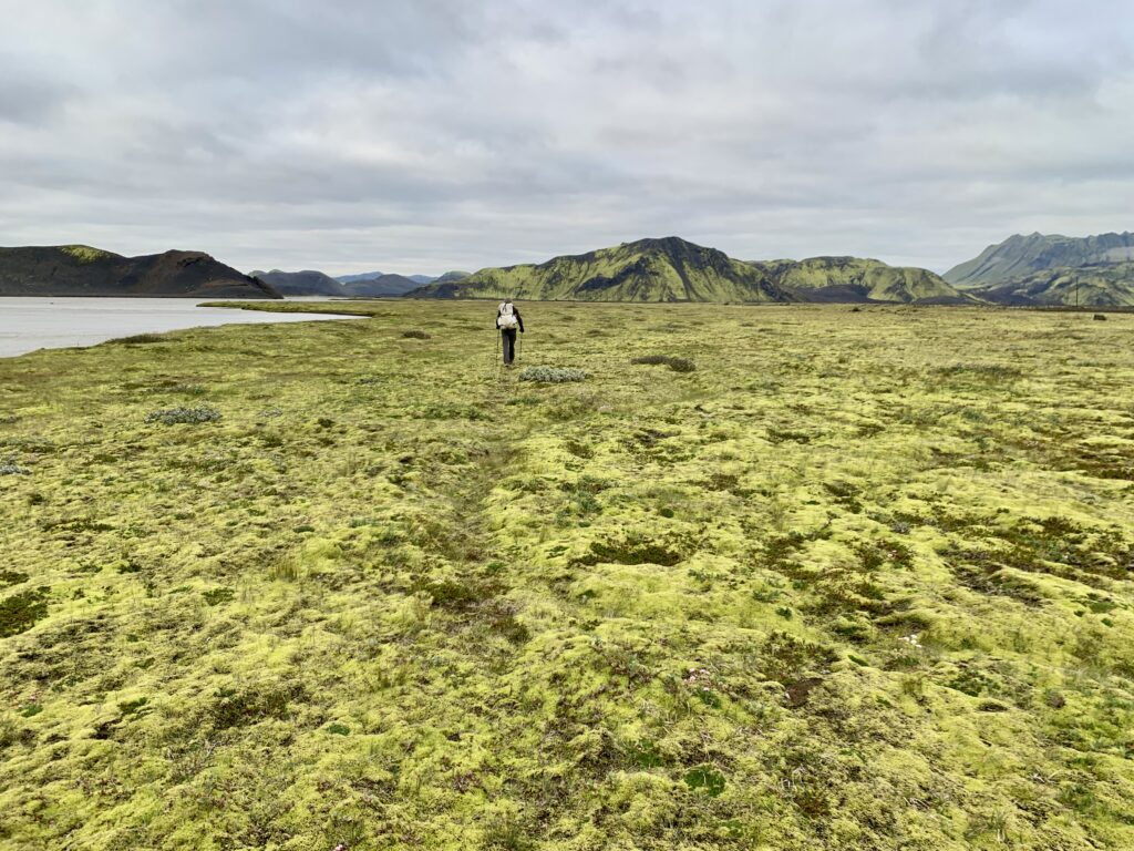
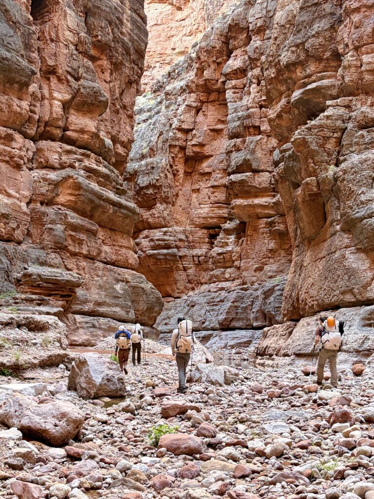
Off trail travel in the Grand Canyon is objectively hard. It’s often steep, with loose and/or sharp rocks, and lots of pokey things. It didn’t take long for my body to get back into a familiar rhythm. After many hours of experience in this type of terrain, I’ve developed confidence here. Oh yea, I remembered, my body knows how to do this.
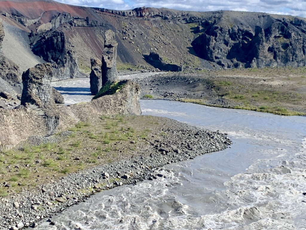
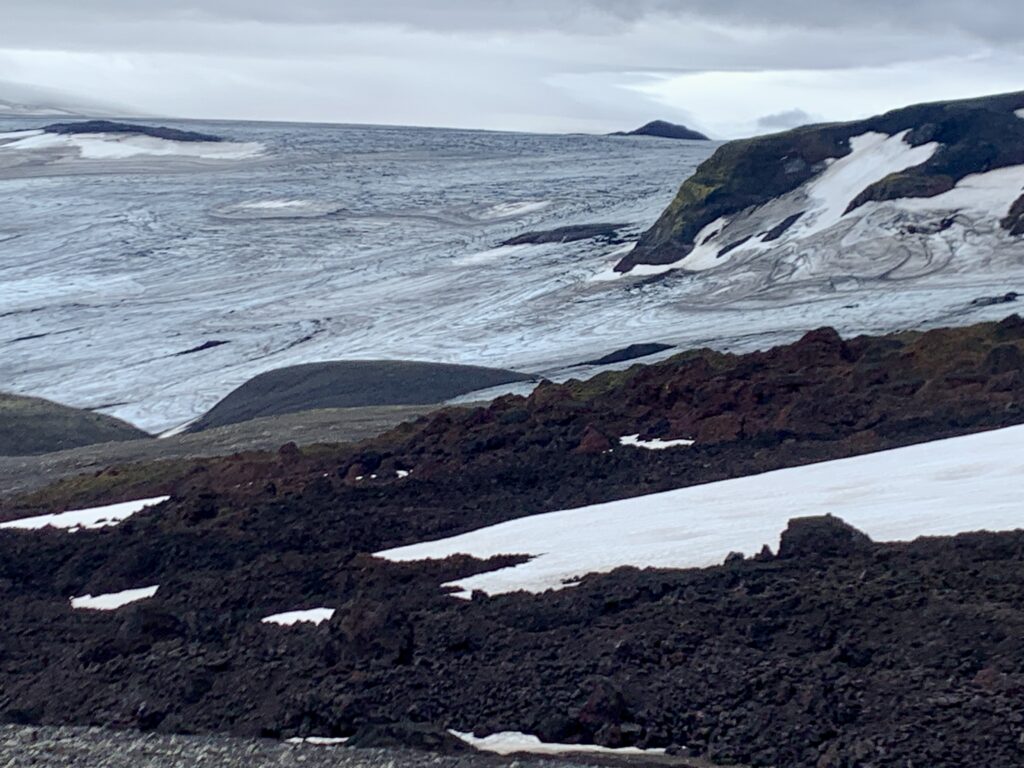
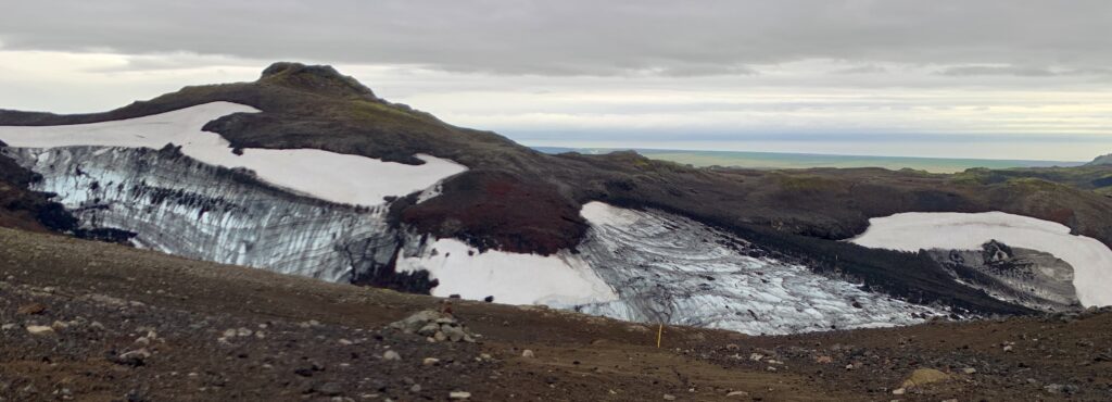
The next rappel dropped us 200’ through the Supai layer and into the shade, thankfully. Shortly thereafter, we donned our wetsuits and continued down through the Red Wall. The canyon was stunning and so wet! We traveled through polished billion year-old limestone with maidenhair fern and monkey flowers growing from rock crevices. We laughed, played, and admired our surroundings. Hours passed unnoticed.
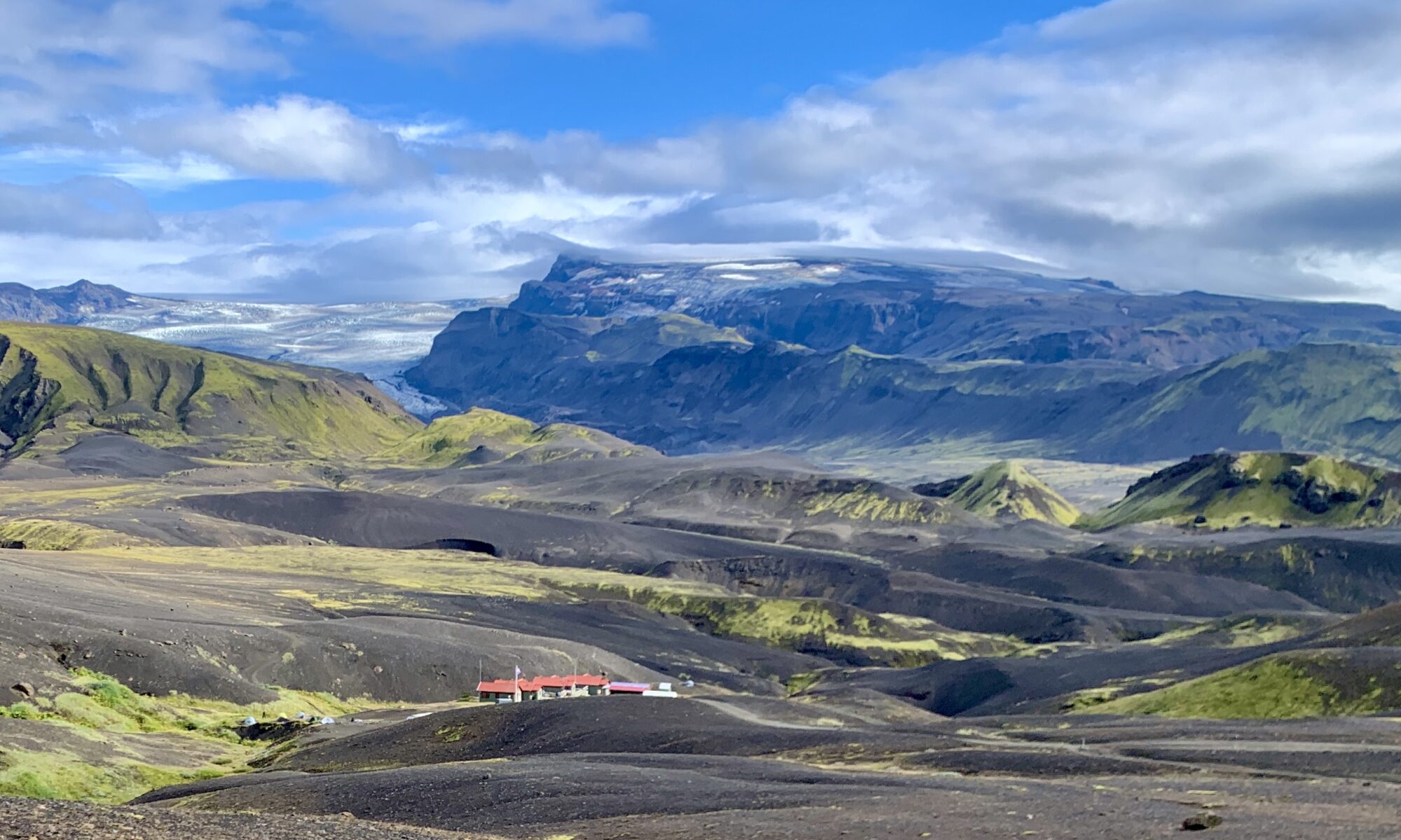
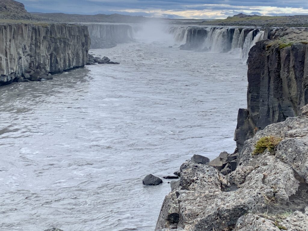
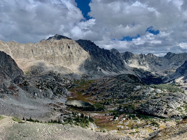
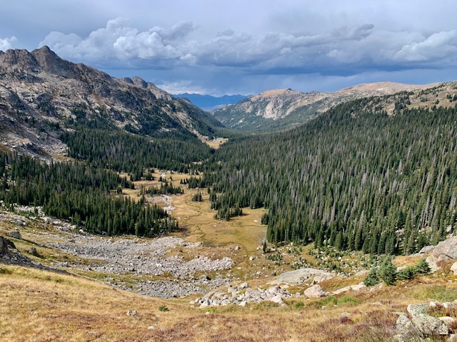
Nearing the final rappel, the light was beginning to change on the opposite wall of the canyon. We heard the river’s roar, though we couldn’t yet see it. We reached the canyon’s mouth around 6 and found a camp on a few small Muav ledges overhanging a beach. After finding our way down a rubble slope to the river, we collected water, and reconvened for dinner just as the last of the light left the sky.
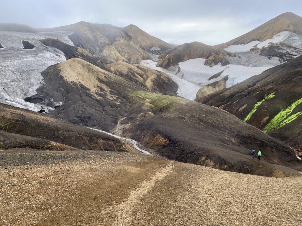
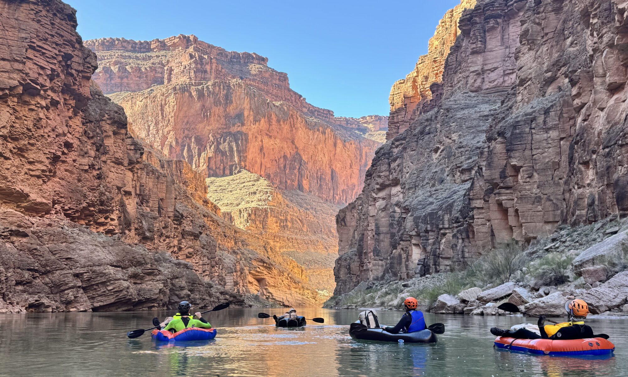
What an incredible day. As I drifted off, the river of stars above, I felt deep gratitude for this place and the team I was with. Tomorrow was a full day of exposed ledgy river walking with a short river crossing to end the day. All things that felt very comfortable. The heat forecast was extreme (low 90s in the inner gorge) and with a team of five, travel would be slower, but I couldn’t wait.
Day 2: Upriver
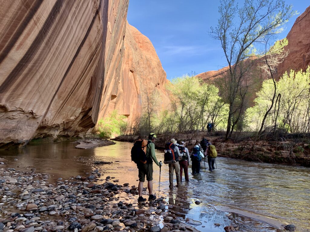
The heat wave arrived right on schedule, pressing down into the inner gorge with a physical, heavy weight. Winding our way up canyon on a ledge system above the river, I savored the early morning coolness, knowing we’d be baking as soon as the sun crept lower on the canyon walls. By mid-morning, the thermometer pushed into the 90s, and the canyon walls transformed into a massive brick oven, radiating the absorbed solar energy back at us. The landscape shimmered in the desert haze.
In this type of heat, we knew we’d need to be mindful of resource management: our water, our electrolyte intake, our pacing, our energy. The terrain is rugged and we couldn’t afford for any of us to make missteps, like rolling a boulder or slipping onto a cactus, due to fatigue or heat exhaustion. We traveled steadily and mindfully, regularly identifying when it was time to drop under a limestone overhang for a mandatory shade break. We rationed water carefully, dipped our clothing into the river when we had the chance, and checked in on one another.
By late afternoon, we reached the crossing to the mouth of our next canyon. Looking at the eddy line, I realized I felt entirely different than I had when I was here just one year prior. The water was still swift, but the deep, paralyzing anxiety was gone, replaced by a quiet familiarity.
As we neared our crossing, we watched a private raft trip hit a wave configuration just downriver from us. The force flipped the big boat, dumping both passengers into the current. Within moments, the rafters surfaced, grabbed their lines, and scrambled back aboard. No panic, no disaster, no big deal I noted internally in an attempt to reassure myself.
We inflated boats and the crossing went as smoothly as I’d hoped. The first mini test of the skill I was most anxious about went great. We made camp on a narrow ledge as the canyon walls turned an impossible, fiery gold. We enjoyed a relaxing dinner above the river, satisfied with a good day.
Just as we were all settling in for bed, I heard some rustling above my head to the right. Must be a mouse, I thought, since we were not far from a well-used boater camp. I considered ignoring it, hoping it wouldn’t pester me all night, but decided instead to turn on my headlamp to scare it away.
Instead of a mouse, I saw a 15″ rattlesnake about two feet from my face, slithering straight towards me. I pushed myself backwards and slid out of my quilt, keeping an eye on it as it explored around my sleeping pad. I gently informed my companions that we had a rattlesnake in our midst. After observing it with fascination for ten minutes, we all moved our sleep setups and gear up a 20-foot class 3 crack to a new terrace and set up all over again. Eventually the adrenaline subsided and we drifted off.
Day 3: The Grotto and the Squeeze
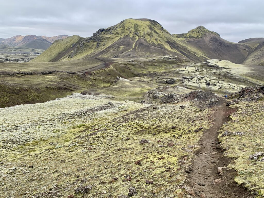
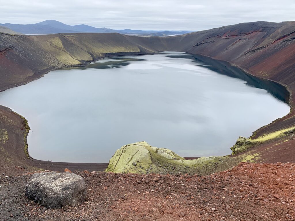
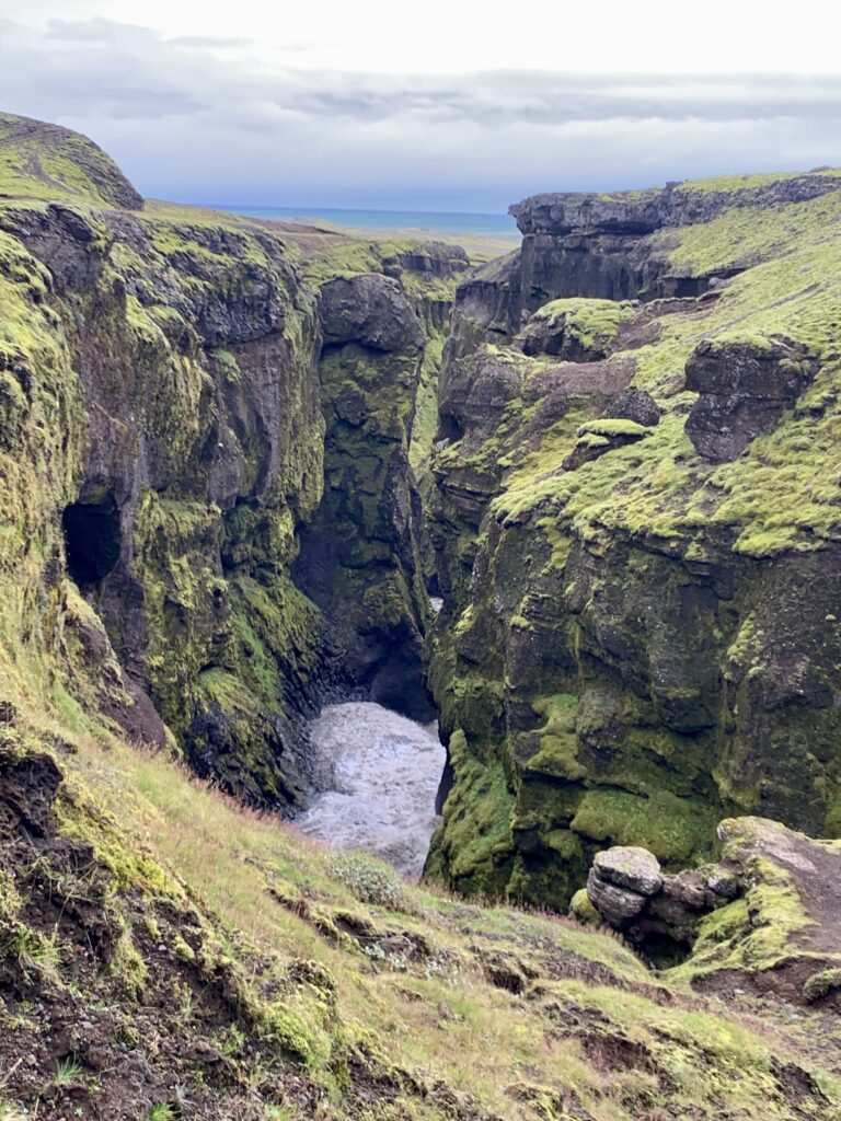
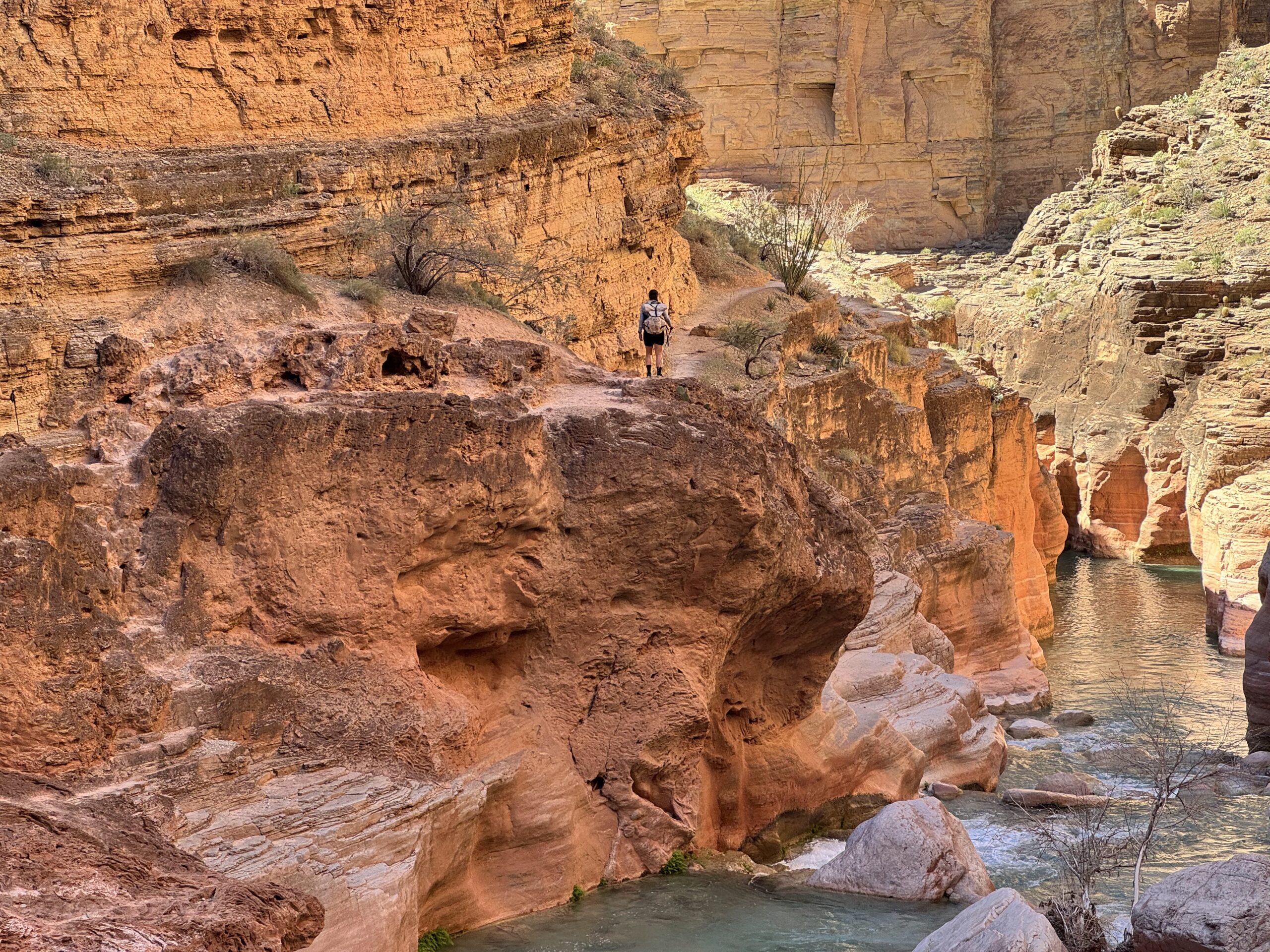
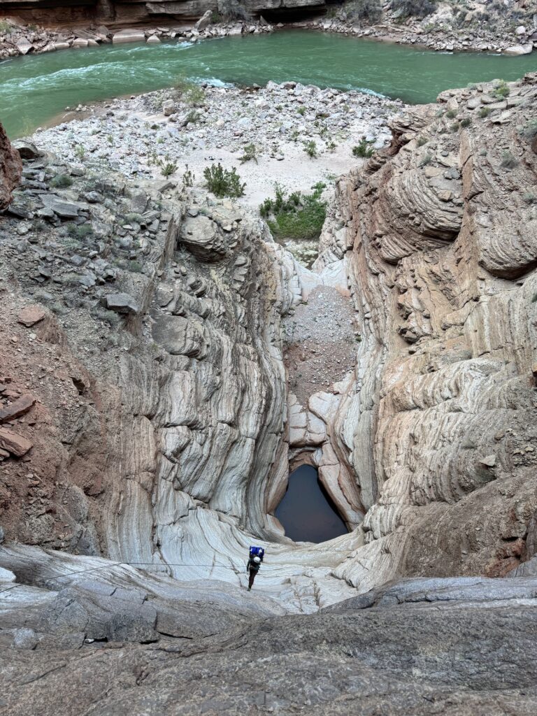
We woke early to ascend our canyon. From the rim above, you would never guess what secrets are hidden in the Muav layer below: a magical, winding limestone grotto filled with water so clear it looks like liquid glass. We made incredible time, working as a seamless unit to navigate a tricky, jammed chockstone that required precise footwork and a bit of teamwork.
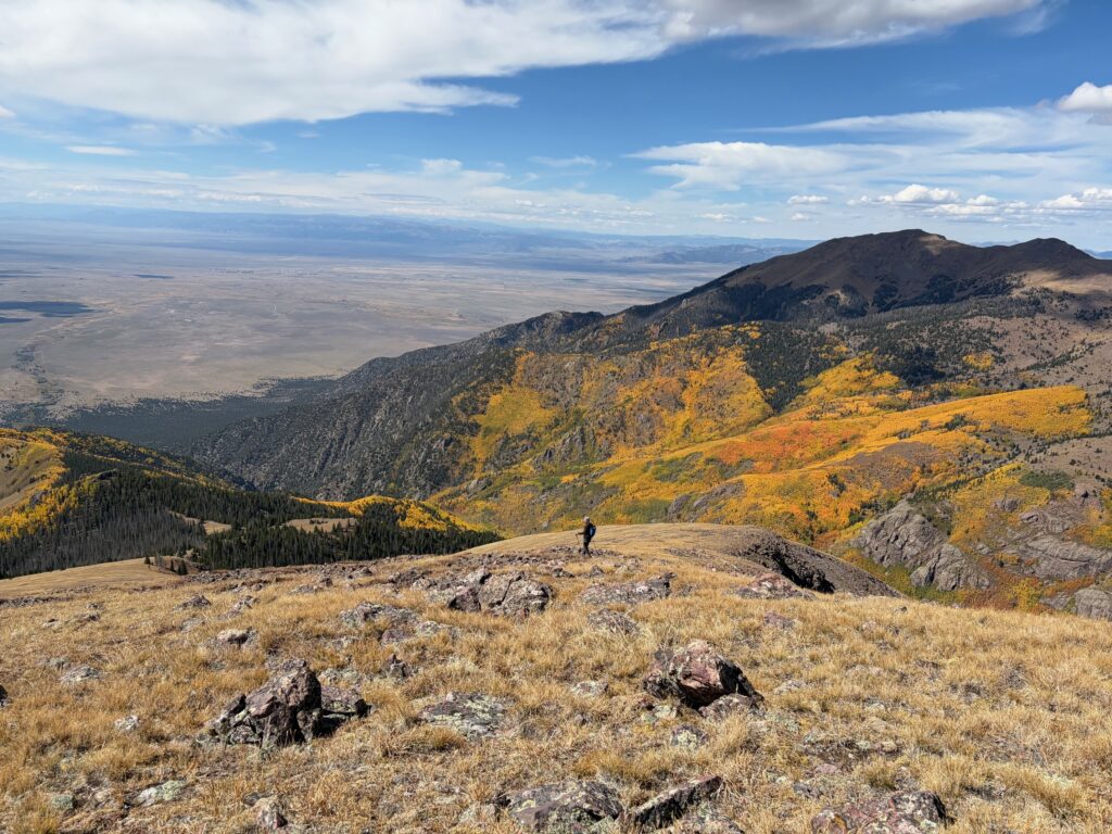
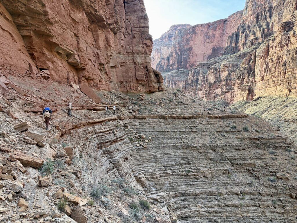
By midday, we reached our exit where we’d overland and drop the next canyon to the east. We scrambled up a short, steep chute and onto the punishing, sun-bleached bench just in time to catch the hottest part of the day. Feral burros had heavily impacted the area, creating a zig zagging maze of trails. As our water bladders ran low, we arrived at the head of our next canyon, hot, dusty, and thoroughly baked.
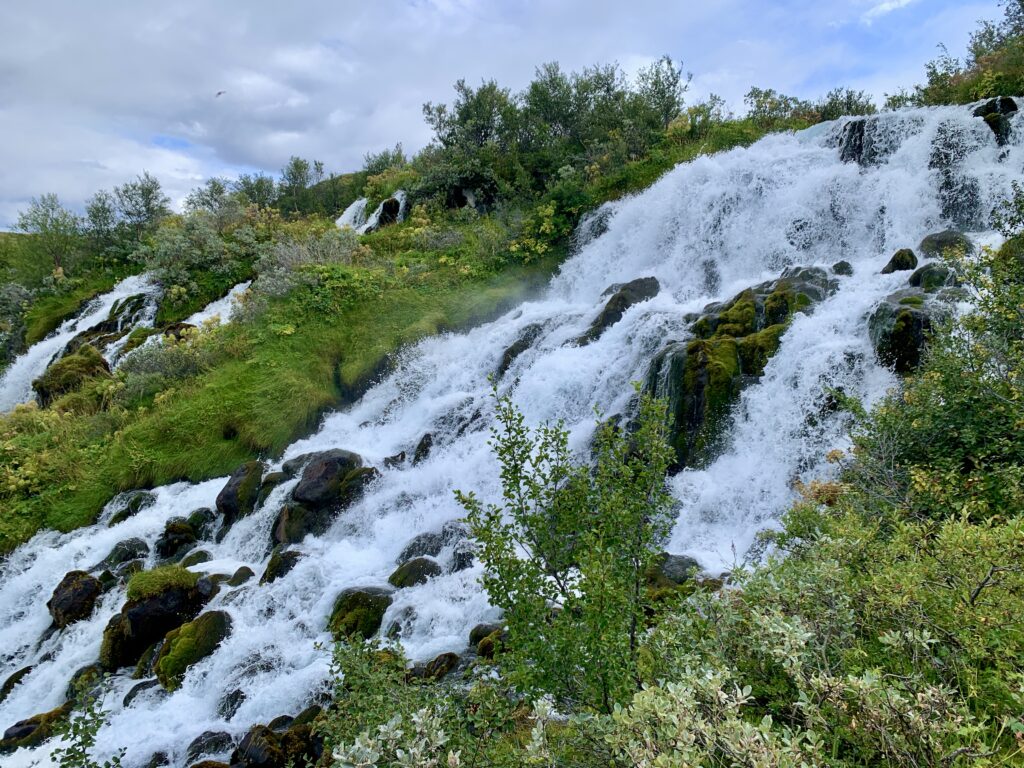
There is a unique, deeply humbling struggle in trying to pull a thick, tight neoprene wetsuit over a body that is completely covered in sweat and desert grit. But the reward was immediate: dropping into the first deep pothole of the canyon felt like a total nervous system reset. We spent the next several hours rappelling into and swimming through emerald pools. It was the perfect temperature for such a wet canyon.
I was able to set up anchors by myself just fine and didn’t hold the team up at all. I was proud of how far my canyoneering skills had come, yet found myself vacillating back to uncertainty in myself at other times. I noticed that when I was indulging in self doubt, it caused me to show up as hesitant and apologetic. In turn, that caused my teammates to (understandably) show up with more hand-holding than was necessary. It was a helpful realization.
We exited the technical section in the late afternoon light and walked back to the confluence with the canyon we’d ascended that morning. We ascended (again) to where we’d stashed our packs and settled into camp. Another flawless day. My technical skills were holding up just fine, but more importantly, my mind was finally beginning to rest.
Day 4: Overland and Dropping In
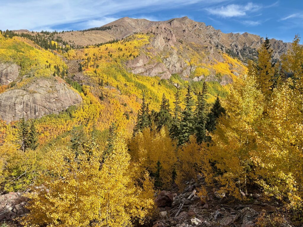
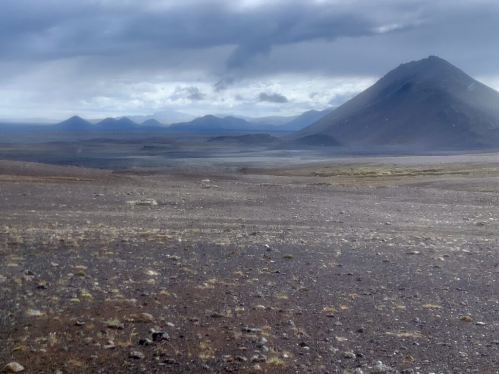
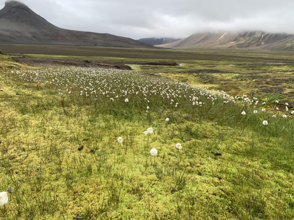
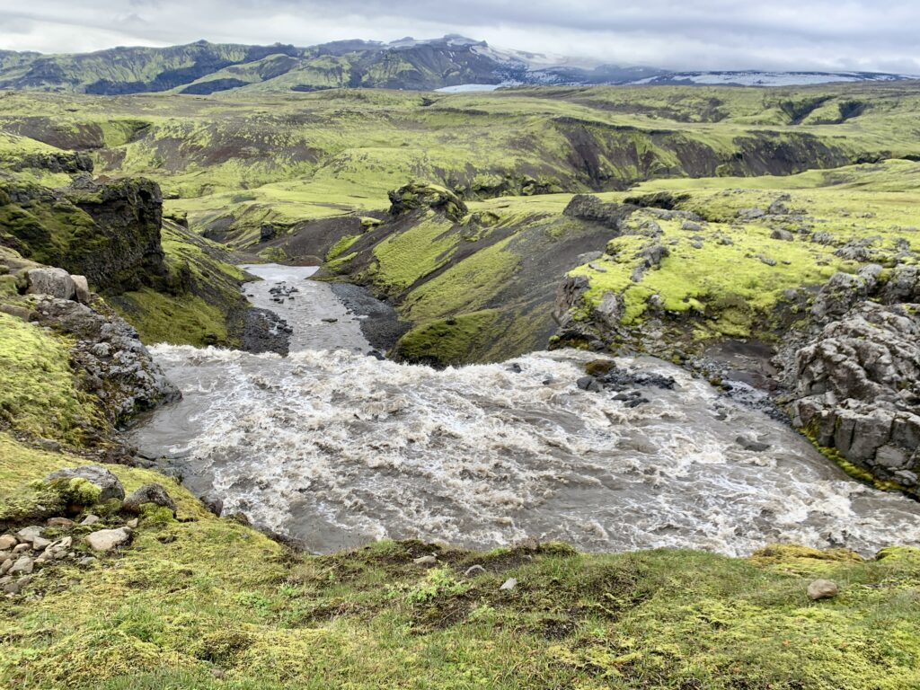
The next morning, we crossed the overland plateau toward our next canyon objective. The desert was in vibrant bloom; stalks of bright yellow Prince’s Plume and deep pink Penstemon lined our route. Seeing these familiar friends brought joy to my heart and a lightness to my step. We moved quickly, trying to beat the worst of the midday heat wave before dropping into the canyon depths.
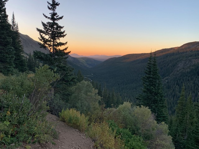
The descent was long and intricate, requiring total focus. The lighting shimmering off the canyon walls as it shifted throughout the day was some of the most beautiful I’ve ever seen. We worked efficiently as a team and reached the river by late afternoon with a 150’ rappel off some old pitons, dropping us right onto the beach. I felt gratitude to my teammates for sharing their knowledge, being patient with my learning, and ultimately helping to empower me.
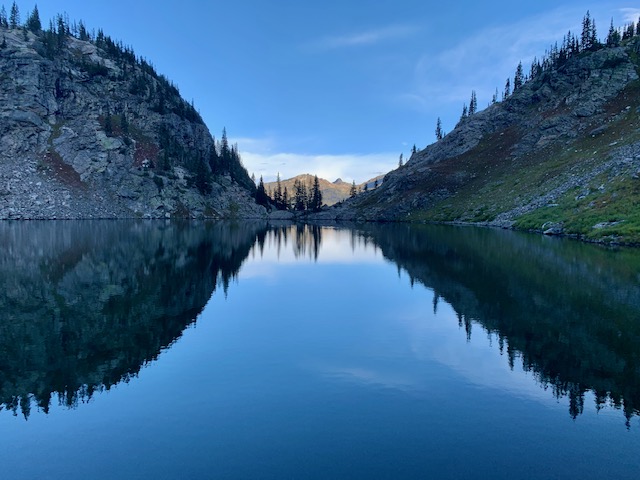
Although beach camping means finding sand in your coffee, your quilt, and your teeth, you cannot beat the luxury of falling asleep to the deep, resonant echo of the river bouncing off a two-thousand-foot vertical wall.
Tomorrow was the big river day. I was still slightly worried, but had also relaxed over these past few days, built rapport with my teammates and confidence in my skills. Lying awake for a few minutes before sleep took me, I realized something vital about the concept of a “beginner.” Yes, I had less time in a boat than the others. But I had thousands of miles of skills that would serve me as a boater. My years of backpacking gave me an automated baseline of grit, situational awareness, and environmental adaptation, among other things. I wasn’t an anchor; I was a fully capable teammate who happened to be new to paddling.
Day 5: The Test of the River
The day I had spent five months dreading had finally arrived: a full day on the river.
The first half of the day went great. I was nailing the lines, handling my boat well, and feeling more and more confident. I even had more than a few moments where I allowed my anxiety to subside enough to experience the pure joy of this mode of travel.
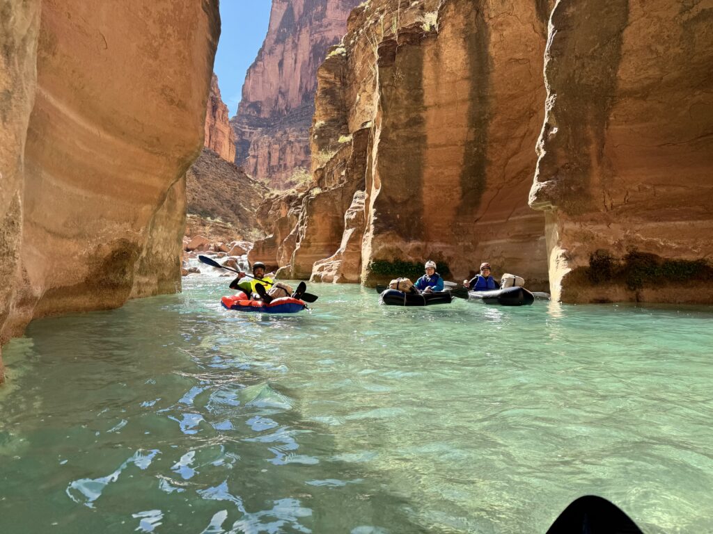
We floated into the mouth of Havasu Canyon, where the legendary turquoise water merged with the muddy green of the Colorado. We hiked up the side canyon, a lush oasis of bright green, newly budded cottonwood trees, accompanied by the cascading, descending song of the canyon wren. We stopped at Beaver Falls, swam in the travertine pools, and ate gluten-free snacks shared by a passing commercial rafting party who also gifted us fresh fruit.
Sitting on a warm rock, a wave of peace washed over me. It struck me that I hadn’t looked at a phone, checked a headline, or ingested any modern noise in five days. My nervous system felt completely settled, open, and clear.
Then, it was time to inflate our boats for the remainder of the float to camp. The afternoon started with the biggest, most intimidating rapid of the itinerary. I studied the line, dropped in, paddled hard, and nailed it. A surge of relief and confidence rushed through my chest. I can do this.
A few miles downriver, we entered a series of smaller, seemingly insignificant riffles and rapids. It was the kind of terrain where your guard drops. The boater ahead of me chose a line, and as I followed, I realized I had let myself get too close to his stern. Fearing a collision, I hesitated, back-paddled to kill my momentum, and instantly lost my steerage.
The river caught my edge, tilted the horizon, and flipped me into the cold, swirling depths. Without thought or panic, I popped my head out of the water (paddle still in hand!), located and swam to my boat just upriver, right-sided it (miraculously finding that my pack was still inside!), and pulled myself over the side tube. Back in the hull, I reoriented my body to the paddling position, turned my boat downstream and rode out the last wave trains of the rapid.
My worst fear had materialized and no one in my party even realized it had happened with the exception of the last boater. “Are you okay?” he asked. “Totally fine!” “Good job! I didn’t even have time to get over here before you were back in. Need to go to shore and reset?” “I think I’m good” I chirped back, surprising myself probably as much as him. And onward we floated down the river as I processed the event, elated that the thing I had feared had finally happened and it just wasn’t a big deal.
I didn’t die, or lose all my stuff, and the group didn’t have to rescue me. We just kept on floating. The entire rest of the day I was relieved it happened because now I didn’t need to worry about it anymore. And I think I showed the group that they didn’t have to worry about me either.
In the last mile of the float, as the afternoon light began to fade, we pulled over to a small beach to put on layers. Across the river on the cliffs above, we saw a Bighorn Sheep lamb pacing back and forth on a small ledge trying to find a way up the broken cliff face. Noticing some movement above, our eyes scanned up, where the mother sheep stood, staring down at her baby, bleating instructions. We watched, transfixed and horrified, as the baby continued to struggle. We couldn’t figure out how it had gotten down there or how it was going to escape. In a feat that only hooves can accomplish, the mother defied gravity as she descended a vertical wall to baby’s ledge. They nuzzled, and then baby followed mom back up the way she’d descended. Sometimes you just need someone to show you what you’re capable of. Relived and running out of daylight, we climbed back in our boats and paddled on.
Days 6-7: The Lessons: Re-wiring the System
That night, we camped on a wide, sandy beach. The constant roar of the rapid next to us acted like white noise as we ate dinner, treating ourselves to the leftover cookies from the commercial rafters. As I lay on my back under my quilt, staring up at that dense river of stars framed by the black silhouettes of the canyon rims, I started to pull apart the pieces of my 3 AM anxiety.
The catastrophe had happened. I had swam. And the world had kept right on spinning. I didn’t hold up the team, I didn’t lose my gear, and I didn’t need to be rescued. The monster under the bed was just a little bit of cold water.
As I reflected on the trip, I realized how much energy I had spent fighting a phantom. I did bring value to the team. When a teammate suffered a minor hand wound the next day, my wilderness medicine background kicked in, and I calmly cleaned and dressed it. My ability to read the terrain and pick off-trail lines had helped us travel efficiently in the heat.
So why does the inner critic convince us that we must be completely flawless to be worthy of entering a room, a team, or a canyon? Why do we feel we have to earn our place through mastery rather than through presence and effort?
The Illusion of Linear Mastery
We are socialized into a system of linear mastery. We are taught that life is a ladder: you start at the bottom as a low-status, vulnerable “beginner,” and you only earn safety, respect, and belonging when you reach the top as an “expert.” This system teaches us that being less than perfect makes us a burden.
But nature doesn’t work in linear hierarchies; it works in niches. A desert ecosystem doesn’t value the hawk “more” than the lichen. Each has a specific, complementary function that keeps the whole system alive. On our expedition, I didn’t need to be the best boater to be a valuable part of the unit. The group system didn’t need five identical experts; it needed a balanced collective of skills, endurance, humor, and care.
The Socialization of “Perfectionism as Protection”
Women, in particular, are deeply conditioned into using perfectionism as armor. The internal script says: If I am perfect, I am safe from criticism. If I never make a mistake, no one can question my right to be here.
This creates a default setting where we only enter rooms where we already know we can excel. My internal perfectionist system was screaming in the weeks leading up to this trip because it couldn’t guarantee a flawless performance. When you notice these judgments waking you up at 3 AM, it is time to interrupt the pattern and ask: Where did I pick up this belief, and is it one that I want to keep operating with?
The Observer Effect of Self-Doubt
The realization I had on Day 3 was watching how my own self-doubt created a destructive feedback loop. Because I felt like the weak link, I acted hesitant and overly apologetic. I asked for help when I could have challenged myself to try first. The group, sensing my projected fragility, responded exactly how a good team should: they over-functioned for me. But their protective response only served to reinforce my internal narrative: See? They think you’re incompetent too.
The moment I flipped my boat, rescued myself, and popped back up into the paddling position with a smile on my face, I shattered that loop. I taught my nervous system that it was safe to fail, and I showed the group system that they didn’t need to rescue me.
When the Beginner Mindset Serves (and When it Hinders)
Growth only happens at the edge of our comfort zones. To navigate that edge safely, we have to know when the “beginner” mindset protects the team, and when it actively damages us.
When it serves
-
- It checks complacency: In the avalanche world, human factors and heuristic traps are categorized by the acronym FACETS (Familiarity, Acceptance, Commitment, Expert Halo, Tracks, Scarcity). Complacent experts often miss obvious red flags because “they’ve always done it this way.” A beginner operates with “Empty Cup” learning. They ask the simple, powerful safety questions: “How do we feel about this anchor? Is this the safest line we can take?”
-
- It expands your window of tolerance: Letting go of the need to lead allows you to practice radical humility and build authentic connection through vulnerability.
When it hinders
-
- When it morphs into shame: Humility keeps you safe; shame shuts you down. Shame floods the nervous system and freezes the prefrontal cortex—the exact part of your brain you need to clear a Class III rapid or descend a technical rappel. You cannot learn if you are busy apologizing for existing.
The Challenge: Low-Stakes Failure
As we hoisted our heavy packs and began the long, winding climb out of the canyon on Day 7, my body felt tired but light. An inner story and belief system had undergone a necessary rewrite. If we want to step into true self-leadership, we have to intentionally train our bodies to tolerate the discomfort of not being the best. We have to give ourselves permission to be “in process.”
I considered how this story had held me back in other areas of life. Where else was I refusing to play because I’d been socialized to believe that being the “least skilled” made me the “least valuable”?
If you want to break the spell of perfectionism, you have to practice. Start small: Choose one low-stakes failure this week. Go do something you are bad at, in front of other people, and watch what happens. You won’t die, the room won’t leave you, and you might just find that you were better than you expected. You don’t need to be perfect; you just need the willingness to get back into the boat when the river turns you upside down.